Sunday, August 30, 2009

Another Awesome Jocassee Adventure

Lake Jocassee Sailing, Camping, and Waterfall Wandering Weekend

Oconee County, SC  Pickens County, SC  and Transylvania County, NC
Friday August 28th and Saturday August 29th, 2009
With Captain Johnny and Andy


Another Awesome Jocassee Adventure


For several months, Johnny, Andy, and I have been talking about getting together for a weekend on Lake Jocassee. I have been wanting to visit Sky Falls on Rock Creek which requires bushwhacking about a mile up the creek from Lake Jocassee.


While you can access this point via a long hike on the Foothills Trail, a much easier way is by boat. Also, by camping out we could get there much earlier in the morning during prime light. So that would be our plan for Saturday Morning.

We all agreed to try and get out of work a little early on Friday so we can launch the boat early enough to see some sites around the lake before setting up camp. Andy and I met Johnny at his house at 3:00pm and hit the road towards Devils Fork State Park at Lake Jocassee.


I have hiked with both Johnny and Andy many times before. However, never together. I was surprised when I realized that this was the first time they had actually met in person.
The weather forecast called for a 80% chance of rain, and being that I was planning on setting up a tent would surely bring those rain chances to 100%. However, some of the most incredible lake scenes happen just before or after rain showers. We were not about to cancel the trip due to a weather forecast!

On Hwy 11 just north of Cleveland, SC we passed by Wildcat Falls and saw there was barely a trickle of flow. The area definitely needs some rain, but hopefully it will somehow miss us this weekend.


Somewhere on Hwy 11 near Table Rock the sky opened up with one of the heaviest rain showers I have ever seen. It sure will be fun trying to launch the boat in this, I thought. It probably rained close to 2-inches in about a half hour, but fortunately it had completely passed by the time we reached Devils Fork State Park.


We launched the boat and had several hours of daylight to explore around the lake.


Wright Creek - Right Time


The first stop was Wright Creek Falls. When the Lake is full, Wright Creek Falls right into Lake Jocassee. After another dry summer the lake is currently at about 15-feet below full pool, which reveals a nice Sandy Beach at the base of Wright Creek Falls. Perfect to set up the tri-pods and get some nice photos of this really cool waterfall.


There is short scramble path on the left side of the waterfall that leads to an upper drop. There are no roads or trails that I am aware of anywhere near this waterfall, so the only way to reach it is via Boat.

Other than a little mud coloring to the water from the earlier rain shower, we were definitely at the Wright Creek at the right time!


Moondance via Moondance


Next, we took the boat up the Whitewater River fork of the lake and docked where the river enters the lake. A few hundred yards upstream is the very impressive Moondance Falls.


Several years ago Johnny took Waterfall Rich to this spot. Rich asked Johnny what the name of the waterfall was, and Johnny said it didn't have one. Rich decided to name it after Johnny's boat "Moondance", and posted some photos of "Moondance Falls" to his http://www.ncwaterfalls.com/ website.


Rich's site is by far the most valuable online resource for Carolina Waterfalls, and since he posted photos of Moondance Falls, several other sources have picked up on the Moondance Falls name for this very impressive waterfall.


Hopefully Johnny's legacy will live on and future maps and publications will all pick up on the Moondance Falls name and the story about how it came about.


It's a tough little scramble to get to from the lake, especially with the rocks all wet and slick from the earlier rain shower. However, it is still much easier than trying to access it from upstream! As far as I am concerned, via boat is the only way to safely visit Moondance Falls making it a very appropriate name!


Moonshine on Moondance


Darkness was approaching and we were on the complete opposite end of the lake from where we planned on camping. If you are looking to move around the lake at high speed, Johnny's boat is not the way to go. We were about 2 hours from where we planned on setting up camp.

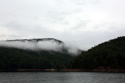
We enjoyed a awesome display of the evening twilight sky over the lake and surrounding mountains . After that faded, we put the cameras away for the night and pulled some other stuff from my cooler in the cabin of the boat. That Crystal Clear elixir of the Gods!


A very enjoyable few hours passed before we docked the boat for the evening in complete darkness at a muddy beach at the mouth of Rock Creek. We toted our tents, sleeping bags a few hundred yards up the Foothills Trail and set up camp with only a mostly cloud covered moon and some flashlights to break the darkness.


After Andy and I set up our tents, Johnny hung around for a little while to enjoy a few more swigs of the Crystal Clear Elixir of the Gods before returning to the cabin of his boat for the evening. Andy and I were planning an early start the next morning, so we retired to our tents as well.


It was perfect sleeping weather. With the cascading creek beside the tents and a good dose of shine in my blood, I slept like a rock!


The Sky is the limit


Andy and I got up shortly before 7:00am grabbed our packs and camera gear and started our bushwhack up Rock Creek. Johnny decided to pass, as he had visited Sky Falls just a few weeks ago.


While Andy and I bushwhacked to Sky Falls, Johnny would take his Kayak on the lake and explore up the Toxaway Fork of Lake Jocassee. This part of the Lake is too shallow and Rocky to bring the sailboat, so the Kayak would be the perfect vessel.


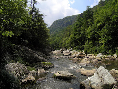
The bushwhack up Rock Creek was much easier than I was anticipating. Some parts were made even easier by just trekking through the creek in ankle to knee deep water, so I wouldn't recommend it in cold weather.


Rock Creek plunges over a cliff and falls close to 150-feet in a series of drops to form the very spectacular Sky Falls.


We did not pass any No Trespassing signs, but I am pretty sure the waterfall is on Private Property. There is a small shack of a cabin on the left bank overlooking the waterfall, but fortunately there was no sign of life there during our visit.

Since our boots were already wet, getting in the creek was not a problem and gave us the option of virtually unlimited composition angles. We spent close to an hour photographing the falls before deciding to move on.


There is at least one more substantial drop upstream called Indian Ford Falls. However neither of us knew much about it our did any research as to how to get there. Looking at Sky Falls, we decided there was no way to safely advance upstream on either side.

We knew that Waterfall Rich had visited Indian Ford Falls several years ago and he got there by descending down from somewhere in the Round Mountain Community.


We backtracked downstream a little and connected to the path leading away from the earlier mentioned cabin. We assumed this would take us into the Round Mountain Community.


This might have been the steepest path I have ever been on. I can't imagine anyone taking a passenger vehicle up or down it. I can only assume that the cabin's owner's park near the top and take an ATV down to their cabin.


That was a grunt of a climb, but we made it to the top and saw several other homes along with an impressive view of Lake Jocassee far down below. As long as we didn't come across any No Trespassing signs, we would continue on.


We took several paths back towards the creek which all fizzled out in the incredibly steep terrain. The most promising one was at the end of OL'Looney Coon Road. A long rope lead down a scramble path. I figured that must lead to somewhere.


It led to Hell! Andy quickly gave up. I continued on a little farther before deciding this was not a good idea. Last thing I wanted to do was to injure myself a week before our Yellowstone Vacation! So I turned back as well.


After some after hike research on Google Earth, I believe if I continued on, I would have ended up at the cliffs just above Sky Falls or right along the side of it. Definitely not a safe place to explore alone. I think that Indian Ford Falls is located a good bit further upstream.


Hopefully we can get some inside information from Waterfall Rich as to the best place to access and return again to find Indian Fork Falls. At least for now we know we can get to the Round Mountain Community without passing any "No Trespassing" signs and without having to drive into the development and violate any of the "No Parking" signs. The few people we saw inside the development just gave us a friendly wave and didn't appear to mind us being there.


Rather than heading back the way we came, we took a little side trail which Andy was pretty sure would connect to the Foothills Trail and back to our campsite. Andy led the way taking care of the spider webs. However, he really needs to do a better job of getting the high ones!


Andy was right, we soon entered Gorges State Park and connected with the Foothills trail. Close to our campsite, Andy spotted a bear in the creek.


Moondance sets sail

Actually, it wasn't a bear, it was Johnny exploring the creek. We packed up our tents and camping gear and with Johnny's help, toted it all back to the boat in one trip, and hit the lake.


Once we got into the more open section of the lake, we docked the boat, cleaned it up a bit, and went for a little swim in the lake to clean off the weekend's grime and sweat. Johnny set the sails and the remainder of our journey would be via wind power.


There wasn't a whole lot of wind, but just enough breeze to fill the sails and fill the rest of the afternoon with a peaceful sail on Lake Jocassee.


It was a great weekend, and we squeezed a lot into our little overnight adventure. It was nice to get back on Saturday and know I had all day Sunday to go through the photos, write the trip report, and get ready for my last week of work before Yellowstone!


Thanks Johnny for another awesome Jocassee adventure!


Additional Photos are posted here:

http://outdoors.webshots.com/album/574391977BFIODx

Wednesday, August 26, 2009

2009-08-23 Linville Gorge Hike Report & Photos

Linville Gorge Hike
With Andy and Boone
Sunday, August 23rd, 2009
Babel Tower, Linville River, Fantasy Creek,
Futuristic Wall, West Face Rock, Henson Creek


Back in February, after visiting Babel Tower, Andy and I found a scramble path on the West Side of the Tower which led us to a really neato spot along the Linville River.

We were curious about what was downstream, but further exploration would be almost impossible without getting wet. That was out of the question on that day because the river was about 50% covered with ice. It was way to cold to get in the water, and we weren’t about to attempt walking across any icy surfaces!

We decided that we would plan a return trip during the summer and explore downstream when the water would be warm enough to spend a good bit of the day in the river.

The Linville River below Babel Tower


Well, the summer is almost over so we planned our return.

Our planned route:
- Start on the Babel Tower Trail
- Off Trail scramble down the west side of Babel Tower down to the river
- Follow the river downstream to Henson Creek
- Explore Henson Creek
- Connect to the West Face “Trail” and explore West Face Rock and Futuristic Wall
- Descend down Fantasy Creek to the Linville River
- Cross the river and connect to the LGT
- Head back up to BT / LGT junction and return to vehicle via the Babel Tower Trail.

Usually when hiking the Linville Gorge area, I like to spend the previous evening at my wife’s parents place in Rutherfordton, NC. This really cuts down on the drive time in the morning. However, this time I would be making the entire drive from Spartanburg, SC which meant getting up fairly early.

Sometime during the night some moron crashed into a telephone pole and electrical transformer, knocking out power to over 2,000 Duke Power Customers on the West Side of Spartanburg.

Sometime in the very early hours of the morning, I peaked at the clock and quickly realized we were without power. I couldn’t risk falling back asleep without an alarm to wake me up, so I went ahead a got up.

I was glad I packed all my gear in the truck the night before, because it is a challenge getting ready for a hike while it is still dark outside without power inside. I had to disable the garage door opener and open the garage manually. However, it does not stay open when you do this. So, I had to get Amy out of bed to back my truck out while I held to garage door open.

Despite the morning power outage, I still managed to make it out in time and arrive at the Marion, NC Wal-Mart a few minutes before our 9:00am meeting time. Once Andy arrived we decided to take my truck since we have heard that the condition of the Kissler Memorial Highway (dirt road on the West side of Linville Gorge) has seriously deteriorated since our last visit.

While Andy’s Corolla probably could have made it, the road was definitely in bad shape and we were glad we had my truck. I grabbed one of the few remaining parking spots at the Babel Tower Trailhead and we hit the trail.
View from near the Babel Tower Trailhead


While all the trails heading down the West Side of the Gorge are steep, the Babel Tower Trail is one of the more user friendly and we made good time towards Babel Tower. Despite the crowd of cars at the parking area, we didn’t see anyone on the trail and only a small group of college age kids camping near the LGT / Babel Trail intersection.

Babel Tower

Before continuing our descent towards the river, we decided to check out the view from the top of Babel Tower. I am not sure the best route to take up the top, but this time we accidentally went up a different way and ended up at a completely different viewpoint.

Jack and Boone on Babel Tower


Andy and Boone on Babel Tower
View of Table Rock from Babel Tower

After enjoying the views and breeze from the top of Babel Tower we had no problem finding the scramble path down to the river and arrived at the same spot we visited in February. Only this time, there was no ice on the water.
Climbing down Babel Tower towards the Linville River

Taking a break along the River
(see Andy on the right to get a sense of how big these boulders and rock walls are)

Judging by the puddles in the potholes on the drive in and the overall wetness of the rocks and trails, it was obvious that the area experienced some rain the previous evening. As a result the river was up a bit. Would it be too high for us to attempt our planned adventure?
We didn’t get very far downstream before deciding this was not a good idea. The raging river squeezes through a narrow chasm with sheer near vertical rock walls on each side. While we might be a little more adventurous than your average hiker, we were not crazy enough to continue on with our plan.
Maybe the next time we go through an extreme drought (last summer would have been good) we will try again. But for today, it was on to Plan B.
We still wanted to explore the Futuristic Wall area between Henson and Fantasy Creek, so we scrambled back up to the main trail and descended down the South East side of Babel Tower via the LGT. After a series of switchbacks (very rare for Linville Gorge), we saw some pink ribbons tied to a tree and decided to follow them down towards the river.
Andy Crossing the Linville River
Across the river we could see Fantasy Creek. Actually, you don’t see much of a creek as it flows almost entirely underground. But the obvious creek bed would be our route to follow.
There was no way across the river without getting wet, so that’s what we did. We crossed through waist high water and arrived on the opposite bank without any problems and started our scramble up Fantasy Creek.

View of Babel Tower from the Linville River
This is definitely not a trail, but ribbons tied to trees pretty much lead the way via the path of least resistance. We eventually got to a neato cave at the base of a very impressive rock wall. We continued north along the base of the rock wall in total awe of its magnitude.
I am not exactly sure what is considered the actual Futuristic Wall, and what is considered West Face Rock, but it didn’t really matter. All I know is that this section of “trail” follows along the base of some of the most impressive displays of towering rock walls anywhere!
This is not an official trail, but for the most part it was very easy to follow. It was obvious that someone put a good bit of effort into keeping the route clear. It wouldn’t take much to make this an official and sustainable trail.
We took our time and did a lot of exploring. We tried to find a good place to scramble up the rocks to catch a view, but didn’t see any safe way for us non rock climbers to scale the walls.
Eventually, we made it to Henson Creek and followed that a short distance down to the Linville River where we took a little break and Boone went for a swim.
After our break we explored up Henson Creek a short distance. We would have liked to go further, but it was getting late in the day and we still had a long way back to my truck. We will just have to plan a return visit to further explore Henson Creek!
Henson Creek

Since the return hike was all backtracking and we knew exactly where we were going, it went much quicker. At least until we got to the crossing of the Linville River.
I made it across with no problems, Andy made it across with no problems, but for some reason, Boone refused to get in. The dog just stood on a rock on the other side whining and yelping.
Andy Crossing the River  -  Boone on the Rocks refusing to go any further
 
Andy was convinced that once we got out of site, Boone would gather up the courage and follow us. That didn’t work!

Since leaving Boone behind was not an option, we got back in the River, re-crossed to the other side, and put the leash on Boone. It still required both of us (one pulling & one pushing) to get Boone into the River and eventually across and on with the remainder of our hike.

We were already soaked with sweat and river water when the rain started, so it didn’t bother us one bit. It felt refreshing, especially since it occurred during the grunt climb out of the gorge section of the hike.
This Google Earth Image shows our approximate hike route

The rain stopped shortly before we arrived back at my truck, so we were able to change into dry clothes before hitting the road towards home.

While we did not succeed in our original plan, it was still a great hike and we both got to see parts of Linville Gorge that we have not seen before. There is still a lot of gorge left to explore, so I know we’ll be back!
Jack on the Rocks above the Linville River

Additional Photos from our Adventure are posted here:
http://outdoors.webshots.com/album/574311265ZtGTPO

Friday, August 21, 2009

SSPBDT Poker Night Report

SSPBDT Poker Night
Thursday, August 20th, 2009


The Players:

Jack Thyen
Jeff Martin
Steve Jeffery
Brian Ludwiczak
Scott Moore

Supporting Cast:

Amy Thyen
Lori Martin
Melinda Moore
Christopher Moore


Due to the late arrival of Steve and Jeff, the first hand was delayed by about an hour. While waiting for the late arrivals, I fired up the grill and the rest of us enjoyed a meal of Grilled Shrimp Skewers (with shrimp, pineapple, onions, & mild hot peppers) and Corn-on-the-Cob.

Once the late arrivals made their appearance, they downed a few Skewers and the poker playing began.

While the guys played poker, Scott’s son Christopher hung out in the den watching cartoons, and the wives hung out in the kitchen chatting the night away. Lot’s of girl talk since Jeff’s wife Lori recently found out she was pregnant!

On the poker table, my stack of chips was getting smaller and smaller. That is, until the turnaround hand of the night. After “passing the trash” I was left with a straight. After the first (4) cards where revealed, I realized that no matter what anyone had left in the hole, they could not beat a straight. So I made the biggest bet of the evening.

Steve & Jeff thought I was bluffing and matched my bet. Brian thought he had a higher straight and matched my bet as well. The final card was revealed and I showed my A-2-3-4-5 straight. Then Brian tried to rake in the pot with his 8-9-10-J-K. Either he accidentally threw out the wrong card, or just miss-read his cards, but he clearly did not have a straight, and I pulled in the biggest pot of the evening!

Mistakes like that happen at SSPBDT poker night. After all, we had been drinking!

However, I believe this is the first time ever that Steve did not make up any imaginary hands. He had a few full houses and flushes that actually were full houses and flushes! While he still ended up down $3.00 for the evening he was not the biggest loser!
That award went to Scott Moore, who walked away with $5.00 less than what he started with. I probably would have gotten the biggest loser award, but that one big pot near the end put me up $2.00 for the night.

The big winners of the night were Jeff and Brian who each ended up $3.00 ahead.

I wonder how much baby food, formula, and diapers that $3.00 will buy?

A great time was had by all!


The proposed date for the next monthly SSPBDT Poker night is:
Thursday, September 24th, 2009

Monday, August 17, 2009

Ashton's 8th Birthday Party

Ashton's 8th Birthday Party!
Sunday, August 16th, 2009

Amy and I were invited to Amy's best friend's son's 8th birthday party on Sunday Afternoon. I spent most of the time hanging out by the pool photographing the kids at play. Here are some photos from the event!

The Birthday Boy


Amy and her best friend Kristi


One of Ashtons' Birthday Presents!


Meet Zoey

 Meet Zoey! Amy and I just adopted this beautiful girl!