Little Hump and Big Yellow Mountain
Appalachian Trail
Avery County, NC
Sunday, February 13th, 2011
Photos are posted here:
http://outdoors.webshots.com/album/579773990ZbkLSC
A 2.5 hour drive (one way) means 5 hours of travelling! That’s a bit more than I normally like to do for a dayhike. However, Andy convinced me that this hike would be worth it. And the weather forecast made it the perfect day to visit some of the highest peaks along the Appalachian Trail.
I met Andy and Brenda in Marion, NC and we combined into one vehicle (Brenda's Xterra) from there. From Marion we took US221 to NC194 to US19E. About halfway between the Metropolises of Plumtree and Minneapolis, NC we turned left on Roaring Fork Road and headed up the mountain.
The higher we climbed, the more snow we saw. The paved portion of the road was mostly clear, but once the road turned to dirt, we would have been hard pressed to continue on without 4x4 and high ground clearance. Snow drifts over 2-feet deep remained in the shady areas.
Driving to the trailhead along Roaring Fork Road
We parked at the end of the road (just before the gate) and hit the trail. We started out hiking the Overmountain Victory Trail, a short spur trail that would connect us to the Appalachian Trail at Yellow Mountain Gap.
We took the AT to the east which climbs steeply to Little Hump Mountain. Most of the trail was covered by over a foot of snow which made for a much slower than normal hiking pace. Not to mention all the views which caused us to stop a pull out the cameras every few hundred feet!
View from the Appalachian Trail
Even though we were trekking through snow, we started shedding clothing. Andy and I were quickly down to just a t-shirt and were considering removing the legs from our zip-off pants.
That was until we left the tree sheltered area of the trail and entered the wide open exposed summit of Little Hump Mountain.
Hiking up towards the Summit of Little Hump Mountain
The open faced summit of Little Hump Mountain offers up 360-degree views. However it does not give any protection from the fierce and cold wind which was blowing some 50mph+ gusts! We quickly started layering up again.
Fortunately, just below the summit is an area with some huge boulders which blocked the worst of the wind and made for a nice spot to break for lunch.
Me at the Summit of Little Hump Mountain
Our original plan was to continue on to Big Hump Mountain, but as the trail crossed the summit and headed into the trees on the North side of Little hump the snow was even deeper than what we had been through. Instead we decided to head to Big Yellow Mountain!
Again, once leaving the bald areas and entering into the trees, the snow cover became deep. Most of the time it seemed like only about 6-inches as there was a hard frozen layer a few inches below the surface. However, every so often, our feet would break through the frozen layer and our legs would plunge into about 2-feet of snow.
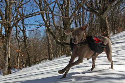
Boone and Brenda hiking through the snow
The summit of Big Yellow Mountain is a huge expanse of open area. The wind seemed to have gotten even more intense. On two separate occasions, my hat was blown off my head and almost got swept over the side of the mountain never to be seen again!
The views from Big Yellow are spectacular and we spent a good bit of time roaming around taking photographs. We hadn't seen another soul all day, but we did run across a group of (3) people on Big Yellow.
Andy, Brenda, and Boone on Big Yellow Mountain
On the hike back down we ran across another group of (5) people and then a stray dog that kept us company for the remainder of the hike and gave Boone a friend to play with.
Boone meets a new friend
We made a short detour to check out the "Red Barn" Appalachian Trail shelter before returning to Brenda's vehicle.
Andy was right! This was a great hike! The weather was perfect and the scenery was spectacular. Also, it was a pleasure to meet up with Brenda for the first time!
Overall, we hiked about 8-miles, but it seemed longer as much of the hike was through deep snow! This is definitely an area I plan on getting back to!
Here is our estimated hike route and elevation/mileage profile:
My full set of photos is posted here:
http://outdoors.webshots.com/album/579773990ZbkLSC


