Windy Falls Adventure
Horsepasture River
Nantahala National Forest
Transylvania County, NC
Sunday, May 17th, 2015
with Andy, Darrin, Dillon, Spencer, and Stephanie
OH SWEET WINDY!
Me at the base of the main drop of Windy Falls
After emerging from my tent I wasted no time packing up my gear. I was super excited about what was to come on this day. Would I finally achieve a goal I set out to accomplish 12 years ago? That photo right above should answer that question!
Note: If you missed day one of this trip report, click here
It dawned on me that this was one of the
few times in my life that I have packed up a dry tent! While we did
have a few very light drizzles, I am hoping that my infamous camping
rain jinx might finally be over!
To keep my pack weight a bit lighter, I decided not to carry any food, cooking gear, or eating utensils. I was quite hungry, so I decided to leave Darrin and Bob at the campsite and start the hike back up to my truck. I figured they would be on their way soon since we were scheduled to meet Andy and Dillon in less than an hour.
The all uphill mile long hike to the Gorges State Park Rainbow Falls parking area was a good little workout to start off the day. I arrived at my truck in plenty of time to eat breakfast and give my wife Amy a quick call to let her know I made it through the night. (Note: Cell service is good at the parking area, but you get nothing down by the river!)
I was surprised to see Stephanie's car in the parking area since I didn't think Spencer and Stephanie would be joining us. It turns out that they changed their minds at the last minute, drove in after midnight, backpacked about 2 miles in total darkness and set up camp near the top of Windy Falls at about 2:30am.
Andy arrived a few minutes before our 9:00am meeting time and Dillon arrived right on time. However, there was no sign of Darrin or Bob. Andy was very eager to get started and catch up with Spencer and Stephanie. By 9:45am I don't think I have ever seen Andy this frustrated!
We really needed to get moving if we wanted to achieve our goal for the day, so Andy drew up a rough map and directions and left it on Darrin's windshield.
A short distance in on the Rainbow Falls Trail, we ran into Darrin and Bob. Bob must have caught some sort of bug the previous evening and was not feeling too well. He decided to pass on the Windy Falls Adventure.
Darrin quickly changed from backpacking gear to dayhiking gear and soon caught back up with Dillon, Andy, and Me. Unfortunately, in his rush to get going, he forgot to transfer his climbing rope into his daypack. We would come to regret that later, but we would not let it stop us!
Getting to the base of Windy Falls is a challenge for even the most experienced off trail waterfall wanderer! However, the first part of the hike is rather easy.
Mountain Laurel in Full Bloom along the Trail
We started out on the Rainbow Falls Trail, turned left on the Ray Fisher Trail, turned right on a Forest Service Road, and then right on an unofficial side trail that led us down to an awesome campsite on the Horsepasture River.
This was the where Spencer and Stephanie had camped the previous evening. Since they were on a tight schedule and we were about an hour behind schedule, they were already gone.
There is an awesome swimming hole and several nice small waterfalls and cascades right next to the campsite which we decided to save for later.
Upper Campsite Cascade (photo taken on the hike out)
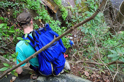
Up to this point it was very easy hiking, but that would definitely change. The next mile is some of the most rugged terrain I have ever experienced! And there is not a trail to follow! There are steep rock faces and cliffs on all sides and if you choose the wrong route, you could easily slip and fall to your death! This was some of the steepest bushwhacking I have ever done!
The Definition of Bushwhacking (with Dillon and Andy)
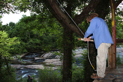
There was one point where we decided to tie Andy's rope around a tree to help with our descent. We probably could have made it without the rope, but the rope definitely helped. However, it would have been even more helpful if we saved the rope for later!
Darrin using Andy's rope to help with a steep descent
Eventually we made it to the top of the main drop of Windy Falls. We were elated to see Spencer and Stephanie way down below hanging out on the rocks!
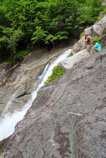
Looking down from the top of Windy Falls
For a sense of scale, can you spot Spencer and Stephanie on the rocks below?
Hint (X=30 Y=20)
Darrin and Dillon at the top of the main drop of Windy Falls
One slip here and you are dead!
We were within view of our ultimate destination, but the most difficult part of our journey was still ahead. A very steep rock scramble took us to the top of a mammoth boulder!
There are basically two ways down from here. You can bring some climbing gear and repel down the side of the boulder, or you can take "The Keyhole" route as the late-great Mountain Wizard (Bob Jones) called it during his trip down the Horsepasture back in 1995.
Since we didn't have climbing gear, we chose "The Keyhole".
There are also two options for entering the keyhole. You can enter the larger slot which has a very scary initial drop-off.
Dillon entering the Keyhole with Darrin looking on
The other option is a safer initial descent, but a much smaller opening. I am 6'1" and right at 200 pounds. I came very close to getting stuck in the smaller opening! If I was any fatter, I would not have been able to make it!
Me stuck in the Keyhole (photo by Andy - taken on the climb out)
Continuing down the keyhole route, things don't get any easier. We definitely regretted not bringing along a second rope! It would have made things much easier and safer. However, with teamwork we were all able to safely make it down to the next stage.
Darrin Climbing down "The Keyhole"
Now on top a sloping rock at the base of the falls, there are two ways to continue on. Go for a Swim or enter the cave. We chose the cave.
Darrin crawling through the cave
That was really cool! And it brought us out the the rocks to join Spencer and Stephanie for the next few hours! We had finally made it to the base of Windy Falls and it was spectacular!
Dillon in awe of the spectacular Windy Falls!
Darrin and Spencer were really wanting to jump off some rocks. There is an awesome swimming hole at the base of the falls, but not quite deep enough to jump off the rocks into it.
Spencer looks on as Darrin checks water depth below the rock he wanted to jump from
However, just downstream is another small drop and another awesome swimming hole! This one deep enough for some rock jumping. Most of us took a turn, including myself!
Me jumping off the rock (photo by Dillon)
Spencer gets some air!
Darrin takes a turn
We spent a few hours playing in the water and photographing the falls. Here are few more shots:
Andy and Stephanie
Dillon photographing Windy Falls
How many people can you spot in this photo?
Spencer in Awe of the Awesomeness that is Windy Falls
Darrin and Spencer playing Camera Catch
Stephanie
Darrin taking a nap
Me at Windy Falls
Eventually Spencer and Stephanie had to head out. The next series of photos kind of shows the route they took.
Spencer and Stephanie Entering the Cave
The Cave will take you to the rock where Spencer and Stephanie are in this photo
(X=70 Y=25)
The Keyhole climb is to the right of them behind the huge boulder
The Keyhole climb takes you to the top of the huge boulder where Spencer and Stephanie are
(X=80 Y=55)
From there it is into the forest to their right for some extremely steep bushwhacking
Eventually you reach the point where Spencer and Stephanie are in this photo
(X=70 Y=95)
After Spencer and Stephanie were out of view, we packed up our gear and began our journey back
Darrin entering the cave
Darrin and Andy climbing up "The Keyhole"
We took our time on the hike out stopping to check out some of the scenery we bypassed on the hike in.
View from the top of one of Windy Falls Upper Drops
Andy at the top of Windy Falls
Huge Boulder in the River
Memorial to a young man who lost his life here several years ago
And a reminder as to how dangerous this place can be!
By the time we finished the worst of the climb we were all drenched in sweat. So we took a nice swim at the base of Campsite Cascades to wash off most of the sweat, dirt, grime, and poison ivy juice!
Campsite Cascades on the Horsepasture River above Windy Falls
The remainder of our hike was very easy, especially compared to what we had been through! We took our time to take a few photos of the flowers, including a nice cluster of Pink Lady Slippers that we somehow missed on the hike in.
Pink Lady Slippers
Rhododendron Blooms
This was an Awesome Day!
Andy and I have been hiking together for over 12 years ago, and
for the past 12 years there have been many discussions about getting to
the base of Windy Falls. We have planned about ten different attempts
over the years, but they always seem to get cancelled for one reason or another. (Usually because of rain as you
do not want to be anywhere near Windy Falls if the Rocks are wet).
After 12 years I can finally say MISSION ACCOMPLISHED!
Windy Falls was worth the wait!
And I will be back!
The complete set of photos is posted here:
https://www.flickr.com/photos/8146392@N05/sets/72157653122129381


