Thursday, September 29, 2011

Linville Gorge Wilderness
Burke County, NC
Sunday, September 25th, 2011


Near the Summit of Hawksvbill

This past Sunday I joined my buddy Andy and his dog Boone for a hike into the Linville Gorge Wilderness. Our plan was to do the following loop hike:

Sitting Bear Trailhead > Devil's Hole > River ford > Linville Gorge Trail > Spence Ridge Trail > Spence / Ledge connector > Ledge Trail > Hawksbill > Sitting Bear Trailhead

This would require a crossing the Linville River, which should not be a problem this time of year. During the summer, the river levels generally stay low except immediately following a very heavy rain. Since there was no rain in the forecast we figured it would be OK.

Andy decided to take advantage of the nice weather forecast and spend the night camping near the trailhead before our hike.

Somehow the weather gods must have mistaken Andy’s tent for mine because a freak storm brought about 5-inches of rain to the area overnight!

Andy could not remember the last time he experienced rain that heavy while camping, but at this time we were not aware of the immense amount that actually had fallen, so we went ahead with our plan and hit the trail.

The Trail Head


The Devil's Hole Trail Sign
We don't know where the Helicopter came from,
but we discussed several theories during our hike.
A miniature alien spaceship seems the most likely explanation

The Devil’s Hole Trail begins at the Sitting Bear Trailhead and descends about 1,200 feet to the Linville River. About half way down, the trail meets up with a small stream which today was roaring!

The trail crosses over the stream several times. On most days, these crossings would be a non-event, but today they were quite challenging!

Based on the way this small stream was flowing, we were not very optimistic about being able to cross the Linville River. However, we decided to keep going to take advantage of what the rain did bring.


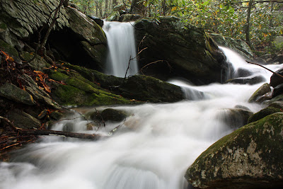
We stopped several times to photograph some nice cascades and small waterfalls, which during most days would not be worth a second look.


Eventually, we made it down to the Linville River and immediately upon seeing the river any thoughts of trying to get across were erased! I have never seen the river flowing this high!

Andy at the Linville River 

We arrived at the river at around 10:30am. Checking out the river flow gauge, you can see that at this time the river was flowing at around 3,000 cubic feet per second which is over 100 times the normal flow rate!


While it was impressive to see the river like this, it did put our hike plans to a screeching halt. With no way to cross the river, there was really nowhere to go from here except back the way we came.

The Linville River


We stopped to check out several more small waterfalls on the tributary stream before eventually making our way back up the 1,200 feet of elevation to the Sitting Bear Trail.


From there we hiked over to Sitting Bear Rock.

Sitting Bear Rock

To me, Sitting Bear Rock does not look like a sitting bear, but it is impressive nonetheless. I am sure there are some nice views from up top, but it would be virtually impossible to get up there without climbing gear. Fortunately there are some nice viewpoints nearby that are easily accessed.


View from near Sitting Bear Rock


Andy and Boone


Boone on a Rock


Andy and Boone checking out the view


After taking a nice lunch break, we hiked on up to Hawksbill and enjoyed the excellent views from there!


View of Table Rock and Linville Gorge from Hawksbill


Andy and Boone on Hawksbill

Even though the high river thwarted our original hike plans we made the best of it and still had a great day of hiking! And we have an excuse to get back and try our planned route again!

The complete set of photos from our hike is posted here:
http://outdoors.webshots.com/album/581134247ToPIxG

Tuesday, September 27, 2011

The Last Day
of our Glacier National Park Vacation
Saturday, September 3rd, 2011

This would be our travel home day.  However, after a nice breakfast at the Glacier Park Inn Bed and Breakfast we still had a few hours to kill before getting to the airport for our flight home.

We decided to check out Whitefish Lake which was kind of in the direction of the airport.  First stop was at a small park along the lake shore.

Whitefish Lake


Whitefish Lake

After that, we drove up Big Mountain which is a ski resort for most of the year. 

Big Mountain Ski Resort

I was hoping for some better views up here and could have got them by taking the chair lift further up the mountain, but we weren't really sure how long that would take so we decided to skip it.

Chair Lift up Big Mountain

Best view I found without taking the Chair Lift

We stuck with the back roads for the rest of our drive to the airport just to see a bit more of the area.

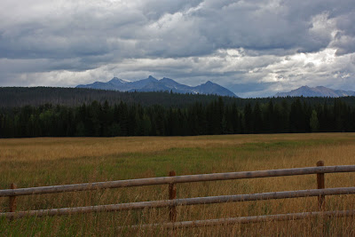
Along the backroads outside of Kalispell, MT


Our last stop was at a little park along the Flathead River.

Amy at the Flathead River

Jack at the Flathead River

It turns out you really don't have to get to the Glacier Park Airport as early as we did.  However, by getting there early we were able to upgrade to exit row seats which gave us a lot more legroom making for a much more comfortable flight back to Atlanta.

The last of over 2,500 photos taking on our trip

It was a great trip and I would definitely like to get back to Glacier National Park again sometime in the future!

Monday, September 26, 2011

The Hungry Horse Dam, and Lion Lake
Hungry Horse, Montana
Friday, September 2nd, 2011

For the last night of our Vacation we checked into the Glacier Park Inn Bed and Breakfast.  In my opinion, this was the nicest of all the accommodations we had during the week and a great ending to a great trip!


One of the best features was the great view of the Flathead river from the back porch!

view from the back porch

I was hoping to get one more short hike in, but didn't really have time to head back into Glacier National Park.  Instead I made the short drive to check out the Hungry Horse Dam.  There was not any hiking trails there, but it did make for a nice photo opportunity.

The Hungry Horse Dam

On the way to the Dam, I passed a sign for Lion Lake and decided to check it out on the way back.  There a nice trail that circled the small lake which made for just the kind of hike I was looking for.


Lion Lake

I returned to the Bed and Breakfast just before sunset and joined Amy on the back deck for some reading, a few FABs (Frosty Adult Beverages), and a nice sunset. 


Amy and Jack


What I was drinking = Moose Drool

After sunset, a spectacular starry sky appeared.  I set the camera up for a 15 minute exposure the capture the star trails.  While the camera was doing its thing, Amy and I enjoyed some snuggling and cuddling under the stars!
Star Trails 

Coming up Tomorrow:
Our last Day

Sunday, September 25, 2011

Polebridge, Bowman Lake, Lower Quartz Lake
Glacier National Park, Montana
Friday, September 2nd, 2011

For our last day at Glacier National Park, we decided to check out the Polebridge and Bowman Lake area.

Polebridge, MT

Polebridge, Montana (Population = 90) is located just outside Glacier National Park and for some reason I wanted to check it out.  Downtown consists of one General Store and One Restaurant.


The only store in Polebridge, MT


The Only Restaurant in Polebridge, MT

We had planned on eating lunch at the restaurant, but they were close.
Business Hours = "Open:  Whenever we feel like cooking"

Fortunately we had enough snacks to tide us over until later, so we continued into the park to the Bowman Lake Area.  Although the road from Polebridge to Bowman Lake is only about 6 miles, it took over a half hour to drive the dirt road.

Bowman Lake is beautiful and there were several hike options that start from the various trailheads at the campground.  I decided on the Lower Quartz Lake Hike for no particular reason.

Deer at the Trailhead Parking Area


Bowman Lake


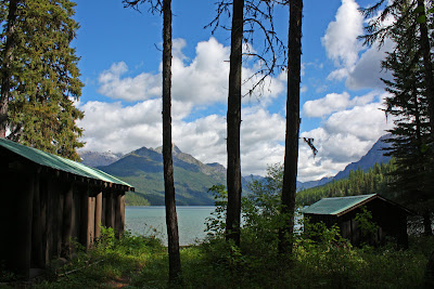
A couple of Cabins at Bowman Lake

Out of all the hiking I did during the week, this would be my last hike inside the park and unfortunately it was my least favorite.  There was really not much to see along the trail and to climb a total of 2,200 feet without being rewarded with any views is kind of disappointing!


One of the only open views on the trail to Lower Quartz Lake

Time did not allow me to continue on to Upper Quartz Lake and my final destination (Lower Quartz Lake was probably the least scenic of all the lakes we've seen inside the park.  However, a less than awesome hike in Glacier National Park is still pretty good, and I did get a good workout.


Footbridge over the creek feeding Lower Quartz Lake


Lower Quartz Lake

I met back up with Amy after completing my solo hike, and together we took a much easier stroll along the Bowman Lake Shoreline Trail.


Bowman Lake


Jack at Bowman Lake


Amy at Bowman Lake


Bowman Lake

After our hike, we headed on to Hungry Horse, MT to grab some dinner and check into the Glacier Park Inn Bed and Breakfast where we would be spending the last night of our Vacation.

The Full Set of Photos from Day 7 of our trip is posted here:
http://outdoors.webshots.com/album/581044800iKmgzl


Coming up Tomorrow:
The Glacier Park Inn Bed and Breakfast,
Lion Lake and the Hungry Horse Dam

Saturday, September 24, 2011

Glacier National Park, Montana
Friday, September 2nd, 2011

I got up early on Friday hoping that the weather would cooperate and I could capture a sunrise from the Aspenwood Resort where we were staying.  To the west it looked like some storm clouds were moving towards us.
Storm Clouds moving in

I got some nice morning twilight shots of some of the horses.

Morning Twilight with the Horses at the Aspenwood Resort

Just as the sun started to rise, the rain started falling.

Sun starting to rise just as the rain started to fall


So we started our drive back towards the West side of Glacier National Park.  The state of Montana has five times as many cows as it has humans.  Therefore scenes like this are pretty common when driving around.

Cows in the Road


This one just didn't want to move out of the way


One thing about having perfect weather is that you don't get to experience the awesomeness of storms rolling in over the mountains.  There was no lack of awesomeness this morning!


For our drive west, we decide to hug the southern boarder of Glacier National Park along Hwy 2.  We made several short stops along the way.

I don't remember what this was all about, but I took a photo of course!


This was called "Goat Lick"
Apparently the rocks release minerals that the goats like to lick.
However, we did not see any Goats here.


The Izaak Walton Hotel.
Neat place, but too expensive for us to consider staying


At the Izaak Walton Inn, they also converted a number of railroad cars into little cabins


A few more roadside views we stopped to check out


Coming up Tomorrow:
Polebridge, Bowman Lake, and Lower Quartz Lake

Meet Zoey

 Meet Zoey! Amy and I just adopted this beautiful girl!