Middle Prong Wilderness Waterfalls
with Mark
Little Beartrap Branch, Middle Prong,
Big Beartrap Branch, and Boomer Inn Branch
Haywood County, NC
Haywood County, NC
Thursday, September 27th, 2018
Me and Mark at Middle Prong Falls
I decided to take Thursday off from work to join Mark on a waterfall adventure into the Middle Prong Wilderness area of North Carolina.
Our plan of attack was to basically follow pages 202 through 204 of the North Carolina Waterfall Bible (Kevin Adam's "North Carolina Waterfalls" 3rd edition).
Here is the GPS Track from the the majority of our day:

We started out at Little Beartrap Branch. This waterfall was nice but nothing spectacular!
Mark and Me at Little Beartrap Falls
Little Beartrap Falls (can you spot Mark?)
Little Beartrap Falls
Lower Little Beartrap Falls
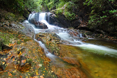
We continued on the Haywood Gap Trail and scrambled down to the Middle Prong. We arrived a short distance downstream from the main attraction at a nice sliding cascade.
Downstream from Middle Prong Falls
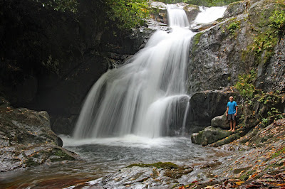
The rocks were wet and very slick, but we safely made our way to the Lower Drop of Middle Prong Falls which was very impressive!
Lower Drop of Middle Prong Falls
Lower Drop of Middle Prong Falls
Mark and Me at the Lower Drop of Middle Prong Falls
Side view of the Lower Drop of Middle Prong Falls
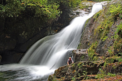
But the highlight of the day was still upstream. We found a relatively safe route alongside river right to get around the lower drop. Middle Prong Falls is a spectacular sight! This one could easily make my list of top 20 North Carolina Waterfalls!
Middle Prong Falls
Mark at Middle Prong Falls
Middle Prong Falls
Me at Middle Prong Falls
After getting our fill of Middle Prong Falls, we scrambled back up to the main trail and continued on to Big Beartrap Branch. These falls were nicer than Little Beartrap Branch, but not as spectacular as Middle Prong Falls!
Mark and Me at Big Beartrap Branch
Big Beartrap Branch
Mark and Me at Big Beartrap Branch
We returned back to the trailhead and decided we had time for one more short hike. So we continued a few miles along FR97 to where it crosses Boomer Inn Branch and followed Kevin's directions to Boomer Inn Falls.
Boomer Inn Falls
Mark and Me at Boomer Inn Falls
That 80% chance of rain in the forecast eventually came to fruition as the skies opened up with a heavy downpour!
We found an easier, but longer route for the hike back to the vehicle. Here is the GPS track from our Boomer Inn Hike:
Despite the soaking downpour at the end of our hike, this was still an awesome day of Waterfall Wandering!
My complete set of photos is posted here:
https://www.flickr.com/photos/8146392@N05/albums/72157698615561002


No comments:
Post a Comment