
Toxaway River Adventure
with Mark and Renee
Gorges State Park
Transylvania County, NC

Group Photo at Upper Wintergreen Falls along the Toxaway River
L to R: Mark, Renee, Me
A little over a year ago my Team Waterfall group explored a relatively remote section of the Toxaway River. My buddy Mark saw my trip report and photos and has been wanting to check it out in person.
This adventure is best and safest with:
- Warm Water (you will get wet!)
- Lower than normal waterflow (very dangerous during high flow)
- Dry rocks
- no rain the previous day or evening
- and no rain in the forecast for day of the hike
We started out along US64 just below the Lake Toxaway Dam above Toxaway Falls.
Rather than scale down the side of Toxaway Falls like I did on my last trip, we decided on the safer route and took the trail that leads to the top of Twin Falls. We backtracked a short bit to view Toxaway Falls from the base.

at the base of Toxaway Falls
We continued on downstream to Twin Falls, which I consider to be the prettiest and most photogenic of all the drops along the Toxaway River!

Renee and Mark at the top of Twin Falls

Twin falls on the Toxaway River

Group Photo at Twin Falls
Continuing on, this two mile section of river we explored contains at least 15 different cascades, slides, chutes, and waterfalls. The Kayaking community has given names to most of them including Space Mountain, Folding Slide, Minigizer, Energizer, Sticky Hole Slide, Big Mank, and Feeding Trough. I am not sure which is which, so I am just going to post some pictures!

Renee and Mark using the butt slide technique

along the Toxaway River

along the Toxaway River
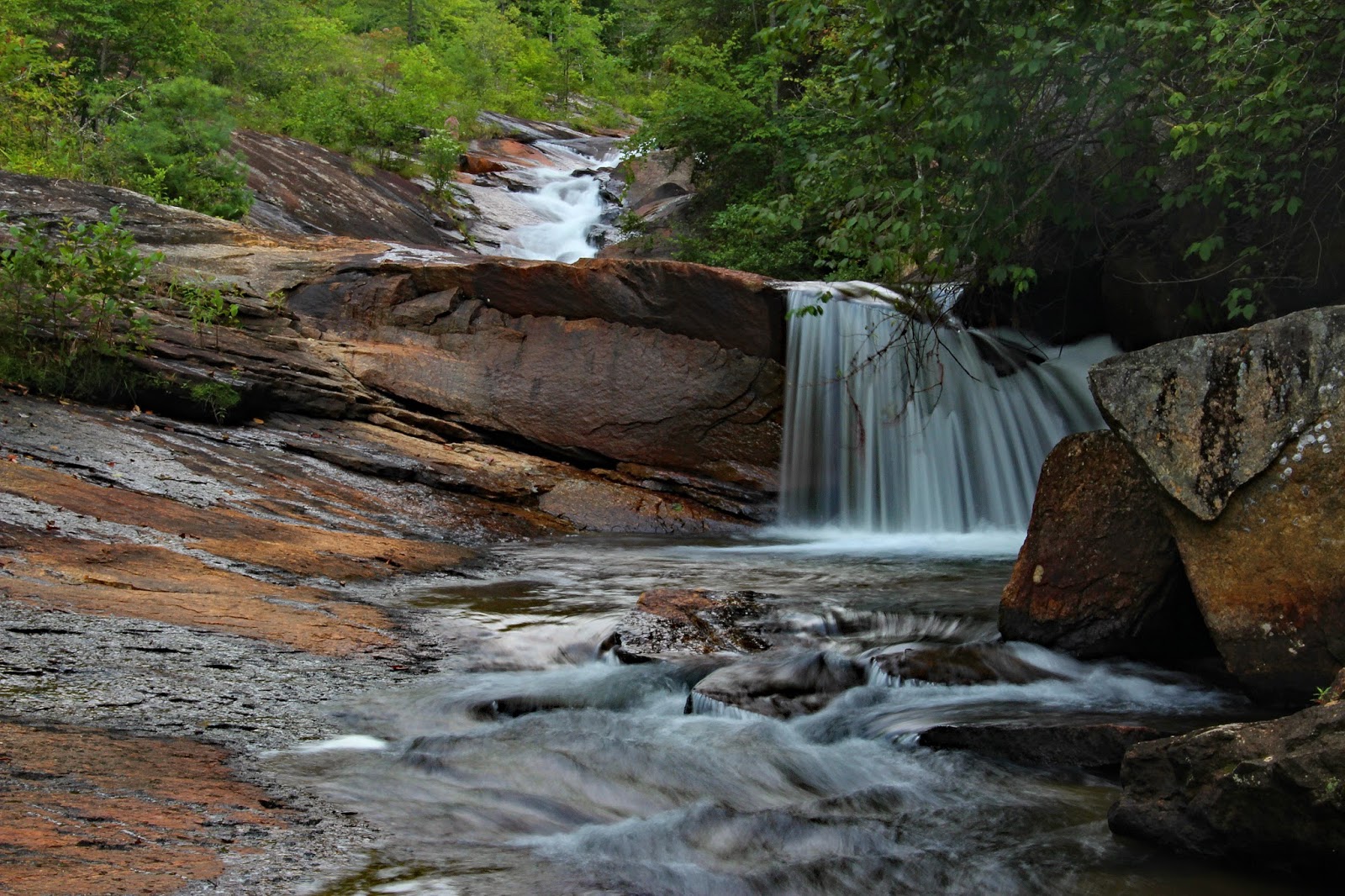
along the Toxaway River

along the Toxaway River

I really liked this slanted rock!

Along the Toxaway River

Along the Toxaway River

Along the Toxaway River
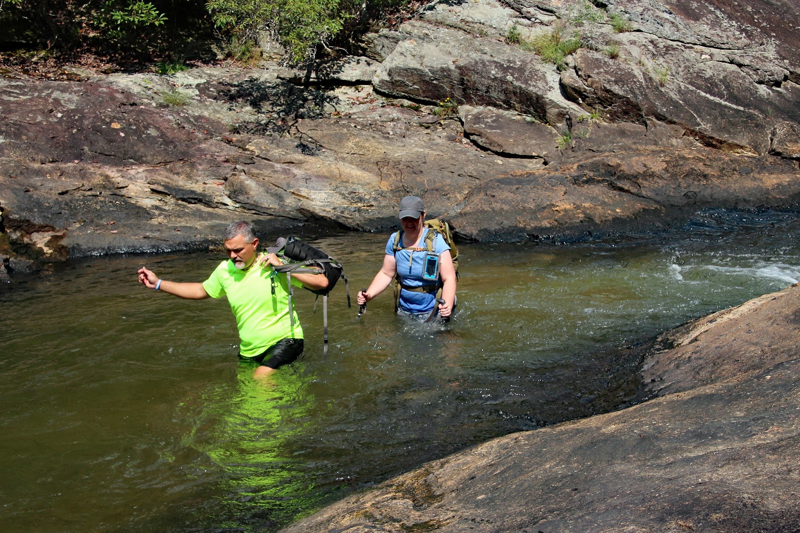
There were a few flat sections of river! This one was a bit on the mucky side!

Renee and Mark trekking through a mucky section of the Toxaway River!
We had at least (3) different close encounters of the buzzing kind. This hornets nest was hanging right over the river! Fortunately Mark spotted it in time and we were able to safely navigate around!

Hornets Nest
This next nest was located just under a rock ledge that I literally butt slid over. Not sure how I escaped that one, but I definitely stirred them up enough that Mark and Renee had to find another way down!

Wasp Nest
We also ran across the World Famous One-Eyed Frog!

The World Famous One-Eyed Frog!
Here is a series of shots of Mark and Renee that show what kind of trek this is!


Here are a few of Renee's Photos:

Mark, Renee, Me
(photo by Renee)

Me and Mark on a natural rock bridge
(photo by Renee)

Me, Renee, Mark
(photo by Renee)
Eventually we made it down to Upper Wintergreen Falls. The Uppermost drop of Wintergreen Falls is one I like to call 2nd Twin Falls.

2nd Twin Falls

2nd Twin Falls
Immediately downstream from 2nd Twin Falls is Upper Upper Wintergreen Falls

Mark and Renee at the top of Upper Upper Wintergreen Falls

Upper Upper Wintergreen Falls
And finally Upper Wintergreen Falls

Upper Wintergreen Falls
Before starting our climb back out, there was one more thing I wanted to do. Just downstream from Upper Wintergreen Falls is a really cool water slide. Mark and I each rode the Wintergreen Slide about 4 or 5 times!

Mark riding the Wintergreen Slide
And here is a link Mark's video of me riding the slide:
Lower Wintergreen Falls is a bit further downstream, but that one is easier to approach from the other direction, so we decided to save that for another trip!
The climb back out was uneventful, but I do have an amusing story.
At one point I made a wrong turn which got us slightly off track and took us across a short short section of private property. Out of all the places that I could have stopped to pee, I just happened to pick on where a motion activated game camera was pointed at me which did not notice it until mid stream! Someone might have a little more than just Deer on their memory card!
We got back on the right path and successfully made it back to our vehicles without any major mishaps! It was an awesome day of adventure!
My complete set of photos is posted here:
https://www.flickr.com/photos/8146392@N05/sets/72157685863845473


