Friday, May 31, 2019

Jack and Amy's 2019 Colorado Vacation - Day 1

Jack and Amy's 2019 Colorado Vacation
Garden of the Gods Selfie
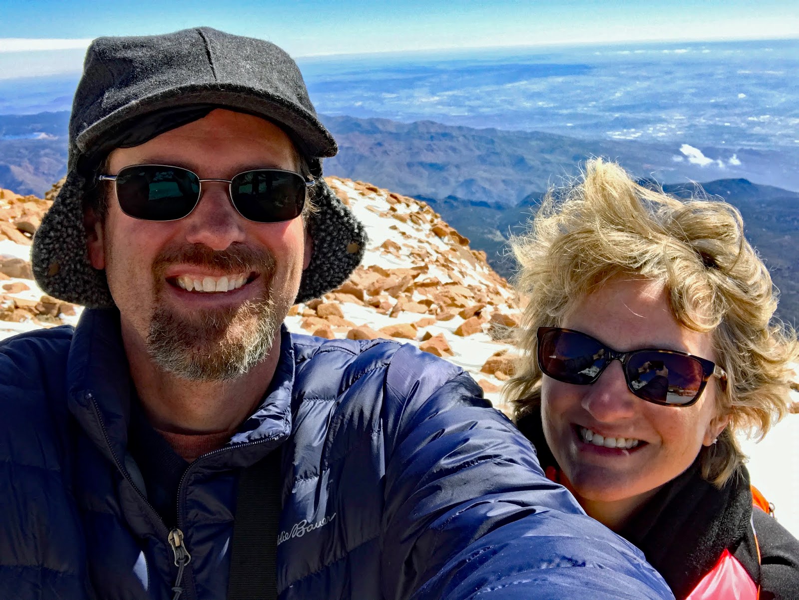
 Pike's Peak Selfie


Introduction and Day 1
Saturday, May 25th, 2019

For years Amy and I have been talking about taking a trip out to Colorado.  However, something always seems to come up causing us to delay our plans.  We finally had an opening in our schedules that allowed us both to tack on a few extra days to the Memorial Day weekend.

So we booked our flights and found a cute little Airbnd in Cascade, CO at the base of Pike's Peak!

Most of Saturday (Day 1) was spent in Airports and on Airplanes, but we eventually landed in Colorado Springs.  A few day's prior I sent a message to an old friend and neighbor of ours who moved out to Colorado Springs about 10 years ago.   She now lives in Texas, but she was visiting her daughter who still lives in Colorado Springs.

It turns out she was flying back to Texas on the same plane that we flew in on, so we were able to reconnect briefly at the airport.  Great seeing you again Sherri!


After picking up our rental car, Amy and I had a nice Lunch in Colorado Springs before making our way to our Airbnb.  Driving through Old Colorado City and Manitou Springs was traffic hell!  We were so glad our original Airbnb cancelled on us and we ended up away from the Colorado and Manitou Springs crowds!  Our places was a delightful little Pueblo style guest cottage perfect for two people!

Our rental cottage

Since we were up at 3:30am the first thing Amy wanted to do when we arrived was take a nap.  I saw there were a few trailheads a short walking distance from the cottage, so I decided to hike up Pyramid Mountain.

Here are a few photos from my hike!
View of Pikes Peak from the Pyramid Mountain Trail

Lots of Deer

Along the Pyramid Mountain Trail

 view overlooking Cascade, CO and Pikes Peak

view of Pikes Peak from the Pyramid Mountain Overlook

At the Pyramid Mountain Overlook

The total hike was about 5 miles (2.5 miles each way) including the road walk portion, with an elevation gain of about 650 feet.

Our original plan was to head into Manitou Springs for dinner.  However we found Manitou Springs to be a very touristy town which on a beautiful holiday weekend was way too crowded for our tastes.  Instead we drove over to Woodland Park.  We picked out a place called Carmen A Tapas Grill and Bar, which turned out to be our favorite restaurant of our trip!

My complete set of photos from day 1 is posted here:
https://www.flickr.com/photos/8146392@N05/albums/72157708857479493

Much more to come!


Tuesday, May 21, 2019

2019-05-18 Appalachian Trail hike to Rocky Bald

Appalachian Trail Hike
Burningtown Gap to Rocky Bald
Plus a visit to Camp Branch Falls
Nantahala National Forest
Macon County, NC
Saturday, May 18th, 2019

This Blog Post is dedicated in memory of Ronnie Sanchez Jr. 
(aka Stronghold)


On the morning of May 11th, 2019, Ronnie Sanchez, an innocent man just trying to find peace along the Appalachian trail, lost his life at the hands on one deranged individual!

This is not what the Appalachian Trail is about, and it deeply hurts my heart that this tragedy was allowed to happen!  Especially considering the sadistic killer was arrested and placed in custody just two weeks prior to his brutal murder of Ronnie Sanchez! 

Although neither of us ever met Ronnie, Scott Burns and I decided to hike a short section of the Appalachian Trail in his memory!   Our plan was to do our best to spread some peace, happiness, and maybe even a little bit of trail magic along the way!

We had a very enjoyable hike from Burningtown Gap to Rocky Bald and back!  Here are some of the photos from our hike.

 Burningtown Gap

Cold Spring Shelter
Yes, there is a spring right next to the shelter and it is Cold and delicious!

 View from near the Cold Spring Shelter

Side Trail to Rocky Bald

 The Professor on Rocky Bald

 Enjoying some cold Brews on Rocky Bald

 view from Rocky Bald

 Mountain Laurel Getting Ready to Pop on Rocky Bald

 Meditation with The Professor on Rocky Bald

The Professor taking a break at the Cold Spring Shelter
According to some sources, this is the oldest shelter along the AT constructed mostly of Chestnut Logs.


We had a very enjoyable hike and hopefully we were able to make this little section of the AT just a little bit more pleasurable for the handful of hikers we met along the way!
 

Afterwards, we decided to stop and do the short hike to Camp Branch Falls near Franklin, NC

 Camp Branch Falls

 Camp Branch Falls

 Bushwhack Jack (Me) and The Professor (Scott) at Camp Branch Falls

Upper Camp Branch Falls


Thanks Scott for showing me around your neck of the woods!

My complete set of photos is posted here:
https://www.flickr.com/photos/8146392@N05/albums/72157691551558123


Tuesday, May 7, 2019

2019-05-05 Yucca Falls and Rachael Creek Falls

Dillon's Birthday Adventure to
Yucca Falls and Rachael Creek Falls
Just outside of Table Rock State Park
Pickens County, SC
Sunday, May 5th, 2019

Group photo behind Upper Yucca Falls
L to R:  Dillon, Scott (aka the Professor), Johnny, Me

Scott (aka the Professor), Johnny, Dillon, Blizzy, and I got together to Celebrate Dillon's 26th trip around the sun with a little waterfall adventure to Yucca Falls and Rachel Creek Falls.


Here is the GPS track from our adventure. 


This route starts from Hwy 11 and stays entirely on public (SCDNR) lands.  An alternate longer route is to start from Table Rock State Park and take the Palmetto Trail west to end up at the same spot.   If you try to follow Rachael Creek upstream from Hwy11, you will be trespassing!

The waterfalls are located entirely off trail.  Once you leave the Palmetto Trail, the hike becomes a bushwhack, scramble, butt slide, creek walk, rhododendron crawl, etc!  Do not attempt this hike if you are not experience in off trail exploring!  I would also recommend sticking to Sundays, especially during deer season, as this is an active hunting area!

Here are some of the photos from our adventure!

Upper Yucca Falls

Blizzy at Upper Yucca Falls

Yucca Falls

 Dillon and Blizzy at Yucca Falls

The Professor climbing down Rachael Creek Falls

Dillon and Blizzy on a log!
They both have much better balance than me!

 Upper Rachael Creek Falls

Blizzy at Upper Rachael Creek Falls

The Professor at Upper Rachael Creek Falls

Group Selfie at Upper Rachael Creek Falls

We had a little bit of rain starting out, and then a period of full sun as we were trying to photograph Rachael Creek Falls!  Other than that, we had perfect weather for this type of adventure!

It was a great day to be outdoors and to celebrate Dillon's 26th Birthday doing what we all love to do!

My complete set of photos is posted here:
https://www.flickr.com/photos/8146392@N05/albums/72157704970799372


Thursday, May 2, 2019

2019-04-27 Linville Gorge Adventure

Linville Gorge Adventure Along the Crystal Trail
with Matt, Lianne, and Geoff
And a visit to Yellow Fork Falls
Linville Gorge Wilderness Area
Burke County, North Carolina 
Saturday April 27th, 2019

Linville Gorge Panorama

This past  Saturday I was invited to join Matt Perry, Lianne Pierrard, and Lianne's boyfriend Geoff for a Linville Gorge "hike" along the Crystal "Trail".  I have never even heard of this "trail" but I am always eager to join in on a Linville Gorge scrambling adventure!

Since the group wasn't meeting until 11:00am, I had plenty of time to do the short hike to Yellow Fork Falls (aka Paddy's Creek Falls) prior to meeting the others.

Yellow Fork Falls (aka Paddy's Creek Falls) is one of my favorite Gorge Area Waterfalls and it has been about 5 years since my last visit.

Yellow Fork Falls (aka Paddy's Creek Falls) 

Yellow Fork Falls (aka Paddy's Creek Falls)

 Yellow Fork Falls Selfie

Yellow Fork Falls (aka Paddy's Creek Falls)

The trail to Yellow Fork Falls is a little over a mile each way (about 2.5 miles out and back).  It is not an official trail so it is not blazed, there is no trailhead sign, and it does not show up on most maps.  However, most of it is easy to follow.  It descends about 700 feet of elevation which makes the climb out is a bit of a workout!

Here is the GPS track from my hike to Yellow Fork Falls!


After my hike to Yellow Fork Falls, I met up with the others to begin our hike along the Crystal "trail". 

The Crystal Trail is an unofficial scramble path that connects the Pinch-in and Dobson Trails.  Again there are no blazes or signs and the "trail" does not show up on any maps that I have seen.   

We decided to do the hike as a short shuttle starting from the Pinch-in and heading south towards Dobson!

Here is our GPS Track:


This hike is absolutely incredible, far exceeding our expectations!  Here are some of the photos from our hike (in order starting North to South):

Lianne, Matt, and Geoff hiking down the Pinch-In Trail

The first of many low flow waterfalls along the Crystal Trail

Crystals along the Crystal Trail

Another Low Flow Waterfall along the Crystal Trail

along the Crystal Trail

Along the Crystal Trail

Geoff along the Crystal Trail

Beware of the Devil's Walking Stick

view from the Crystal Trail

The waterfalls just keep on coming along the Crystal Trail

Geoff along the Crystal Trail

view from the Crystal Trail

Lianne along the Crystal Trail

Along the Crystal Trail

Matt and Geoff along the Crystal Trail

view from the Crystal Trail

Matt along the Crystal Trail

Lianne and Geoff soaking in the views!

Another low flow waterfall along the crystal trail

Cave Sparrow Nest

Interesting Bird and Egg along the Crystal Trail

Tree Hugger Matt

Hiking along Dobson Cliffs

view from Dobson Cliffs

Geoff on Dobson Cliffs

Roadside view on the drive out of the Gorge

The perfect ending to an awesome day in the Gorge!

Thanks Matt for inviting me along on this Adventure!  And it was great to Meet Lianne and Geoff for the first time!

My complete set of photos is posted here:
https://www.flickr.com/photos/8146392@N05/albums/72157691211856923

Meet Zoey

 Meet Zoey! Amy and I just adopted this beautiful girl!