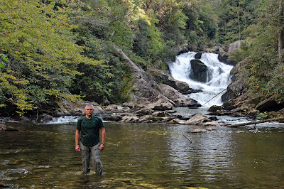
Bearwallow Creek Adventure
Plus Chub Line Falls on the Toxaway River
with Mark Inman
Gorges State Park
Transylvania County, NC
Saturday, September 23rd, 2017
Our main goal for the day would be to explore the section of Bearwallow Creek between Lower Bearwallow Falls and PawPaw Falls. This would include Bear Canyon Falls, Bluff Falls, and Indian Branch Falls.
We would start at the Frozen Creek parking area which would mean a 4.5 mile (one way) hike on the Auger Hole Trail just to reach this remote section of creek deep inside Gorges State Park.
Once we reached Bearwallow Creek there is no trail upstream. Just a creek walk and/or bushwhack following the path of least resistance. Kevin Adam's "North Carolina Waterfall - 3rd Edition" has more detailed directions to these falls (pages 257 through 260).
Right off the bat, there are numerous cascades and small waterfalls. Most of these are un-named, but the first Tri-Pod worthy drop, I am calling Twin Falls on Bearwallow Creek.
Twin Falls on Bearwallow Creek
I had a dry bag for my camera if we encountered any tricky creek walking sections or had to get in above waist deep water. But it seems most of the time disaster strikes when you least expect it. Not only had I not put my camera bag in the dry bag, but I hadn't even zipped the camera bag up when my feet came out from under me sending me (and my camera) into the creek. It was a complete soaking!
The camera seemed to be functioning, but the display screen was dead meaning that I could not adjust most of the settings or review any photos. This has happened before when the camera has gotten exposed to excessive moisture, and it has always recovered once it drys out. So I wasn't overly concerned especially since the camera is about 7 years old. But it is frustrating not to be able to adjust settings or get that instant feedback that we have become accustomed to in the digital age!
We continued on to Bear Canyon Falls! I really like this one, but the way it curves, you can't capture the entire drop in one photo.
Bear Canyon Falls
Next up was Bluff Falls
Me at Bluff Falls
(photo by Mark Inman)
Bluff Falls
We saw no safe way up the side of Bluff Falls so we headed off into the woods for a little bushwhacking until we got to a point where we could work our way back down to the creek well above Bluff Falls.
Kevin doesn't give this next one a name, but I think it is significant enough to deserve being called Pothole Falls!
Me at Pothole Falls on Bearwallow Creek
(photo by Mark)
(photo by Mark)
A short distance upstream we arrived at Indian Branch Falls.
Indian Branch Falls
Me at Indian Branch Falls
(photo by Mark)
Indian Branch Falls
Rather than backtracking downstream, we decided to bushwhack up the hillside. About 500 feet in elevation above the creek runs a forest service road. It was definitely a steep bushwhack, but the forest was fairly open making for a relatively easy bushwhack. Once we hit the forest service road it provided a much quicker return back to the Auger Hole Trail.
Since we were so close, we decided to make a return visit to one of my all time favorites! Lower Bearwallow Falls!
Lower Bearwallow Falls
Mark and Me at Lower Bearwallow Falls
(photo by Mark)
Next up was Chub Line Falls! This one proved much more difficult than either of us was expecting! I am pretty sure we did not follow the path that Kevin recommends in his book because we ended up arriving right at the top of the falls. And there was no safe way down from here!
The Toxaway River just upstream from Chub Line Falls
Me at the top of Chub Line Falls
(photo by Mark)
Side view of Chub Line Falls
(no safe way down from here)
Climbing down the rocks is not a safe option, so we ended up on one hell of a bushwhack! This was not even fun for "Bushwhack Jack" Mark and I both move at a pretty quick pace, but it took us over an hour to travel the 0.1 mile down to the base of Chub Line Falls.
Chub Line Falls
Mark at Chub Line Falls
Chub Line Falls
Fortunately, we found a much quicker route back up to the Auger Hole Trail.
We had also discussed trying to squeeze in Step Around Falls, but decide to save that one for another day. We were both beat and still had about 3 miles of hiking left to get back to the parking area.
Here is the GPS track from our days adventure:
This was an awesome day of adventure and after a day of drying out, my camera seems to have fully recovered full functionality!
My complete set of photos (plus a few of Marks) is posted here:
https://www.flickr.com/photos/8146392@N05/albums/72157686559873390


No comments:
Post a Comment