Thursday, October 19, 2017

2017-10-14 Grandfather Mountain from the Boone Fork Trailhead

Grandfather Mountain Hike
from the Boone Fork Trailhead
Watauga, Caldwell, and Avery County, NC
Saturday, October 14th, 2017

View from the Cragway Trail
Grandfather Mountain State Park

We had our annual SSPBDT Mancation Camping trip this past weekend. This group of friends is not really into the hiking, so I left them at the campsite on Saturday Morning and went for a solo hike to Grandfather Mountain.

I avoided the $20 admission fee by starting at the Boone Fork Trailhead along the Blue Ridge Parkway.

Along the way I stopped at one of the Blue Ridge Parkway Overlooks to check out some above the clouds views!
Above the clouds along the Blue Ridge Parkway

I started my hike by taking the Nuwati Trail up to Storyteller's Rock.

Storyteller's Rock from Below

The trail officially ends at a campsite near the base of the rock, but there are several scramble paths that take you up to the top of the rock for some impressive views!  The spectacular fall color was an added bonus!

View from Storyteller's Rock

view from Storyteller's Rock


From there I backtracked a bit before taking the Cragway Trail up the mountain!  This is a great little trail which has several awesome viewpoints along the way!

 View from the Cragway Trail

 View from the Cragway Trail

View from the Cragway Trail

The Cragway Trail ends at Flat Rock where I took a little break to check out some additional views

 Hanging out at Flat Rock

I continued my climb up the mountain on the Daniel Boone Scout Trail which has a nice distant view of the Linn Cove Viaduct.

view of the Linn Cove Viaduct

All the trails up to this point were new territory to me.  However once I hit the 5,946 ft high Calloway Peak (the actual summit of Grandfater Mountain), I was in familiar territory.

 Out on a Ledge near Calloway Peak

View from Calloway Peak

From the Calloway Gap Junction, I continued on the Grandfather Trail which is one of my favorite stretches of trail anywhere!

Along the Grandfather Trail

 Along the Grandfather Trail

 Along the Grandfather Trail

Along the Grandfather Trail

I had considered going all the way to the Swinging Bridge area, but the crowds started getting thicker and thicker the closer I got.  It amazes me how many more people start their hike from the $20/person trailhead just to avoid about 1,500 feet of elevation gain that is required when hiking from the free trailheads.

There was actually a line of people waiting to climb the latter to the MacRae Peak Summit area!

Heading up to MacRae Peak

I figured the crowds would only get thicker the closer I got to the Swinging Bridge, so I decided to make this my turn around spot.

 view from MacRae Peak

view from MacRae Peak

 View from MacRae Peak
Note:  The people are actually on the trail.  That is one cool section of trail!


I didn't take a whole lot of photos on the hike back down since most of it was stuff I had already seen on the hike up.  However, I did find something that I missed on the hike in.  The remains of an old plane crash.

Plane Crash Remains from May 12th, 1978

Here is the GPS track from my hike


After my hike, I returned back to my friends at Camp Buff.  Once it got dark we decided to have a little fun with some burning steel wool long exposure photography.


Fun with Burning Steel Wool

The rest of the evening was spent relaxing around the campfire!
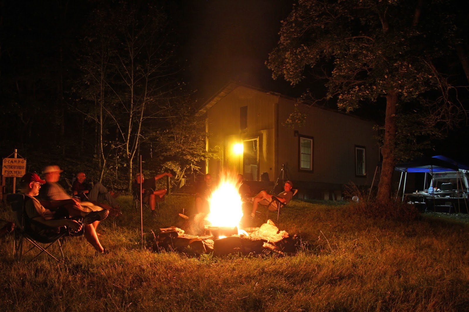
Hanging out around the campfire at Camp Buff

My complete set of photos is posted here:

Hike:  https://www.flickr.com/photos/8146392@N05/albums/72157661616891048

Fire:   https://www.flickr.com/photos/8146392@N05/albums/72157688044712754


Tuesday, October 10, 2017

2017-10-05 Cold Mountain and Shining Rock Loop

Cold Mountain and the Shining Rock
Loop Hike with Mark
Shining Rock Wilderness, NC
Thursday, October 5th, 2017

Mark and Me at Shining Rock

I decided to take the day off from work to join Mark on a 16 mile loop hike into the Shining Rock Wilderness area of North Carolina.  The company that I work for does not allow you to carry over vacation day and our Fiscal year (and Vacation year) ends on October 31st.  So as the saying goes, "Use them or Lose Them!"

Our hike route.  We did the loop Clockwise
(Note:  I did not get a clean GPS track - User Error!)

We started out at Camp Daniel Boone, a Boy Scout Camp located on the Western Edge of the Shining Rock Wilderness Area.  According to the outside temperature gauge on my truck it was 38 degrees starting out!  It felt great to finally hike in cooler weather after a long and hot summer!

We quickly warmed up as the trail gains almost 2,000 feet of elevation over its first 3.8 miles to Deep Gap.

 Me at the Deep Gap Trail Intersection Sign

We took a short break to shed some layers before continuing on to Cold Mountain.  The Cold Mountain Spur adds another 2.8 miles (1.4 each way), and almost 1,000 feet of additional elevation gain!  The views are well worth the effort it takes to get there!
view from Cold Mountain

 Mark at Cold Mountain

 view from Cold Mountain

 The Summit marker on top of Cold Mountain

Me at Cold Mountain

After a nice break on Cold Mountain we returned back down to Deep Gap and continued South on the Art Loeb Trail through "The Narrows", which offers up some nice views.  It is about 3 miles from Deep Gap to Shining Rock. 

view from the Narrows

 Buzzing around some Wildflowers

 Me along the Art Loeb Trail Narrows

 View from the Narrows

Mark along the Narrows
 
 Gentian Blooming along the Art Loeb Trail

 Mark Scrambling down a steep section of the Art Loeb Trail


The Art Loeb Trail takes you around Shining Rock, but you can't see much from the actual trail.  There is a multitude of side trails and scramble paths that will take you to Shining Rock.  I have found that the best way to to come up from the South Side.  My attempt at a short cut bushwhack from the North was definitely NOT a good idea. 

Fortunately after a run in with some evil briers, we eventually did make it on top of Shining Rock, a rare White Quartz rock outcrop deep within the Shining Rock Wilderness!

 Mark at the base of Shining Rock

View from Shining Rock 

 Me on Shining Rock

 Mark on Shining Rock

From Shining Rock, it is a little over 6 miles back down to the Daniel Boone Camp along the Little East Fork Trail.  The first 3 miles is a little overgrown, but still easy enough to follow.  The final 3 miles pretty much parallels the creek all the way back to camp.

 Me along the Little East Fork Trail

There are a lot of nice cascades and small waterfalls, but since I elected to save weight and not bring my tripod, I decided to save these for another day!

It was a beautiful day for a hike!  Much better than a day at the office!  It took us about 8 hours to travel the 16 miles and we only encountered two other humans during our hike.

My complete set of photos (plus a few of Mark's) is posted here:
https://www.flickr.com/photos/8146392@N05/albums/72157689298982186


Monday, September 25, 2017

2017-09-23 Gorges State Park Bearwallow Creek Adventure

Bearwallow Creek Adventure
Plus Chub Line Falls on the Toxaway River
with Mark Inman
Gorges State Park
Transylvania County, NC
Saturday, September 23rd, 2017

Our main goal for the day would be to explore the section of Bearwallow Creek between Lower Bearwallow Falls and PawPaw Falls.  This would include Bear Canyon Falls, Bluff Falls, and Indian Branch Falls.

We would start at the Frozen Creek parking area which would mean a 4.5 mile (one way) hike on the Auger Hole Trail just to reach this remote section of creek deep inside Gorges State Park.


Once we reached Bearwallow Creek there is no trail upstream.  Just a creek walk and/or bushwhack following the path of least resistance.  Kevin Adam's "North Carolina Waterfall - 3rd Edition" has more detailed directions to these falls (pages 257 through 260).

Right off the bat, there are numerous cascades and small waterfalls.  Most of these are un-named, but the first Tri-Pod worthy drop, I am calling Twin Falls on Bearwallow Creek.

Twin Falls on Bearwallow Creek

I had a dry bag for my camera if we encountered any tricky creek walking sections or had to get in above waist deep water.  But it seems most of the time disaster strikes when you least expect it.  Not only had I not put my camera bag in the dry bag, but I hadn't even zipped the camera bag up when my feet came out from under me sending me (and my camera) into the creek.  It was a complete soaking!

The camera seemed to be functioning, but the display screen was dead meaning that I could not adjust most of the settings or review any photos.  This has happened before when the camera has gotten exposed to excessive moisture, and it has always recovered once it drys out.  So I wasn't overly concerned especially since the camera is about 7 years old.  But it is frustrating not to be able to adjust settings or get that instant feedback that we have become accustomed to in the digital age!

We continued on to Bear Canyon Falls!  I really like this one, but the way it curves, you can't capture the entire drop in one photo.

Bear Canyon Falls


Next up was Bluff Falls

Me at Bluff Falls
(photo by Mark Inman)

Bluff Falls

We saw no safe way up the side of Bluff Falls so we headed off into the woods for a little bushwhacking until we got to a point where we could work our way back down to the creek well above Bluff Falls.

Kevin doesn't give this next one a name, but I think it is significant enough to deserve being called Pothole Falls!

Me at Pothole Falls on Bearwallow Creek
(photo by Mark)

A short distance upstream we arrived at Indian Branch Falls.

 Indian Branch Falls

 Me at Indian Branch Falls 
(photo by Mark)

Indian Branch Falls

Rather than backtracking downstream, we decided to bushwhack up the hillside.  About 500 feet in elevation above the creek runs a forest service road.  It was definitely a steep bushwhack, but the forest was fairly open making for a relatively easy bushwhack.  Once we hit the forest service road it provided a much quicker return back to the Auger Hole Trail.

Since we were so close, we decided to make a return visit to one of my all time favorites!  Lower Bearwallow Falls!
Lower Bearwallow Falls

 Mark and Me at Lower Bearwallow Falls
(photo by Mark)

Next up was Chub Line Falls!  This one proved much more difficult than either of us was expecting!  I am pretty sure we did not follow the path that Kevin recommends in his book because we ended up arriving right at the top of the falls.  And there was no safe way down from here!

The Toxaway River just upstream from Chub Line Falls

 Me at the top of Chub Line Falls
(photo by Mark)

Side view of Chub Line Falls
(no safe way down from here)

Climbing down the rocks is not a safe option, so we ended up on one hell of a bushwhack!  This was not even fun for "Bushwhack Jack"   Mark and I both move at a pretty quick pace, but it took us over an hour to travel the 0.1 mile down to the base of Chub Line Falls.

Chub Line Falls

Mark at Chub Line Falls

 Chub Line Falls


Fortunately, we found a much quicker route back up to the Auger Hole Trail.

We had also discussed trying to squeeze in Step Around Falls, but decide to save that one for another day.  We were both beat and still had about 3 miles of hiking left to get back to the parking area.

Here is the GPS track from our days adventure:


This was an awesome day of adventure and after a day of drying out, my camera seems to have fully recovered full functionality!

My complete set of photos (plus a few of Marks) is posted here:
https://www.flickr.com/photos/8146392@N05/albums/72157686559873390


Meet Zoey

 Meet Zoey! Amy and I just adopted this beautiful girl!