Wednesday, November 4, 2015

2015-10-30 Return to Little Cove Creek

Return to Little Cove Creek
Green River Gamelands
Polk County, NC

Milton Bradley Falls
Bradley Cooper Falls
Marilou Bradley Falls
Bruce Bradley Cascades
Vicki Bradley Cascades
and the awesome Cavern Falls!

Friday, October 30th, 2015
with Thomas (The Badger), Scott (the Professor), and Mark

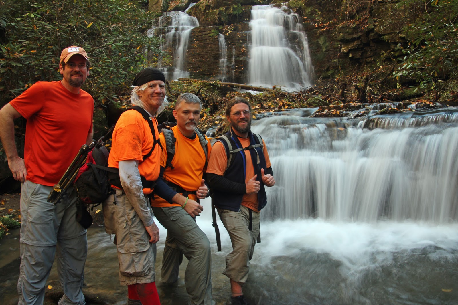
The FAB 4 at Cavern Falls
L to R:  Me, Mark, Thomas (the Badger), and Scott (the Professor)

About Two Months ago, Andy, Brenda, and I found what I consider to be our greatest waterfall "discovery" to date!  Obviously we were not the first humans to stumble across this spectacular waterfall, but as far as we know it has never been documented in any publication either in print or online.  We found these waterfalls strictly by studying topo maps, speculating where waterfalls might be, and bushwhacking into the unknown.

I decided to burn my last Vacation day of the fiscal year to make a return visit and show off our "discovery" to some of my other Team Waterfall hiking buddies.

Thomas (The Badger), Scott (The Professor), and Mark would be joining me on this adventure.

Since I have written about this area several times in the past, I am not going to write a full trip report this time.  You can read some of my previous trip reports for a little more detail:

Previous Trip Reports from our Little Cove Creek Adventures:
http://scjack.blogspot.com/2012/02/waterfall-wandering-bushwhacking.html
http://scjack.blogspot.com/2014/03/2014-03-02-waterfalls-on-little-cove.html
http://scjack.blogspot.com/2015/02/2015-02-22-little-cove-creek.html
http://scjack.blogspot.com/2015/09/2015-08-30-another-little-cove-creek.html

For this trip, I am just going to post some photos:

Amusing Sign near the Trailhead

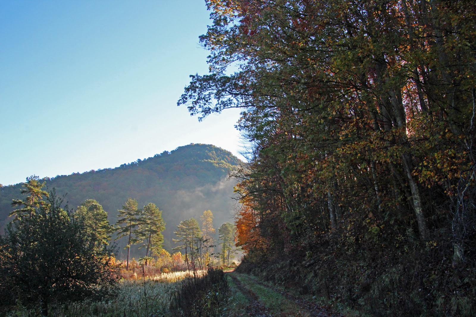
 The road leading into the Green River Gamelands

Moon Over the Mountain

Old Cabin in the Green River Gamelands

Milton Bradley Falls

Milton Bradley Falls

Bradley Cooper Falls

 Marilou Bradley Falls

Cavern Falls

The Gang at Cavern Falls

 Cavern Falls

Badger Selfie inside the Cavern at Cavern Falls

Some nice Falls Color 

Bradley Cooper Falls

The Gang at Bradley cooper Falls
L to R:  Me, Thomas (the Badger), Mark, and Scott (the Professor)

Giant Toad

Note:  If you are wondering about our coordinated outfits.  Hiking through NC Gamelands during Deer Season = Wear Orange!  


The complete set of photos is posted here:
https://www.flickr.com/photos/8146392@N05/albums/72157658400173513


Tuesday, October 27, 2015

2015-10-23 John B. Neale Falls and Bernie's Falls

John B. Neale Falls and Bernie's Falls
Pisgah National Forest
Transylvania County, NC
with Andy, Thomas and Kitty
Friday, October 23rd, 2015

Me at Bernie's Falls


Since our vacation year ends on October 31st and my company does not allow us to carry over vacation days, I usually end up with a few vacation days to use up come October.  This year was no exception.  Therefore, I took the opportunity to join Andy, Thomas, and Kitty on a hike to check out two waterfalls that I have yet to visit!

These are located on Public Property (Pisgah National Forest Gamelands).  However, there are no official trails.  There is a large network of forest service roads and old logging roads that traverse the area.  Therefore, there is not a whole lot of bushwhacking required, however you really need a good map as these roads can get very confusing.

Thomas, Andy, and Kitty trying to figure out where the heck we are!


We parked along Tanasee Gap Road at the gated FR9999 and followed that downhill to Parker Creek.  Once at the creek, we followed that downstream crossing back and forth from one side to the other several times.


At a little over a mile into the hike, a tributary flows from the North into Parker Creek.  If you come to a clearing where Parker Creek enters into farmland, you have entered into private property and have gone to far.    John B. Neale Falls is located a few hundred yards up this unnamed tributary stream.

John B. Neale Falls

John B. Neale Falls was more impressive than I was expecting.  Unfortunately the bright sun was shining directly on the waterfall making for less than optimal photo conditions.

 Andy, Kitty, and Thomas photographing John B. Neale Falls

To avoid trespassing over private property, we back tracked a short ways and found a faint side trail heading up the hill.  This side trail would be tough to spot if you weren't looking for it, but once on it, it is pretty easy to follow.  This pretty much took us up and over the mountain from Parker Creek to the Miser Creek area.

Some nice Fall Color along the trail

At an obvious 4-way intersection we turned right.  We could hear Bernie's Falls down the hill to our left.  But rather than head down to the base here, we continued on to the flats upstream from Bernie's Falls, where we crossed Miser Creek and arrived near the brink of the Falls.

Do not be tempted to try and get to the actual brink of Bernie's Falls as there is a high probability of death if you decide to do so!  Instead we continued on downstream safely away from the brink on river right.

A steep by obvious scramble path takes you down behind the main drop of Bernie's Falls

Kitty and Andy behind the main drop of Bernie's Falls

To work our way down to the base, we crossed over to river left behind the main drop and made our way down to the best vantage point of the awesome Bernie's Falls, named after the legendary waterfall explorer Bernie Boyer!

 Bernie's Falls

Photos do not doe this one justice!  Bernie's Falls is much more impressive in person.  The next photos include some of my Team Waterfall Hiking Buddies to give a better sense of scale!

Thomas and Kitty at Bernie's Falls

 Thomas Photographing Bernie's Falls
(note: I don't recommend trying to get where Thomas is standing!)


After a good bit of time photographing and enjoying the falls, we returned back to the main trail.  From here we pretty much followed the route that Waterfall Rich describes in his www.ncwaterfalls.com Bernie's Falls writeup.

This was an awesome hike to two awesome waterfalls with awesome friends and awesome weather!  Did I mention we had an awesome time!  Total distance of our hike was about 7.0 miles.

 Estimated Hike Route (my best guesstimate!  Not based on actual GPS data)


My complete set of photos is posted here:
https://www.flickr.com/photos/8146392@N05/albums/72157660375022641


Thursday, October 22, 2015

2015-10-17 Linville Gorge Shortoff Mountain Hike

Shortoff Mountain Hike
Linville Gorge Wilderness
Burke County, NC
Saturday, October 17th, 2015
with Kenny, Lisa, and Indie (the Bear Dog)

On Shortoff Mountain

The Linville Gorge Wilderness offers up some of the most amazing scenery anywhere.  Unfortunately, it is on the outer edge of distances I like to travel for a dayhike.  However, since I was already camping this weekend, it would cut my drive distance by more than half!

I arrived to find the trailhead parking area at the end of Wolf Pit Road overflowing with vehicles, so I turned around and found a safe spot to park the truck a good ways back down the road.  Kenny, Lisa, and their dog Indie arrived shortly after I did.

 Indie (the Bear Dog)

I had never met Kenny or Lisa, so we spent some time introducing ourselves and talking about our past hiking experiences.  After about 45 minutes there was still no sign of Josh (the organizer of the day's hike) or any of the others who said they would be joining us.

Eventually Kenny, Lisa, Indie and I gave up on the rest of the group and decided to hit the trail on our own.

We started our hike on the Wolfpit Trail which quickly gains elevation and soon offers up some awesome views of Lake James.

view of Lake James from the Wolfpit Trail

We left the Wolfpit Trail on Rick's Crossover Trail to connect with the Mountains-to-Sea Trail (MST).  From there we decided to bushwhack along the SOCB (ShortOff Cliff Base).

 Kenny, Lisa, and Indie by the SOCB

I am glad I decided to zip on my pant legs because while it was not a difficult bushwhack, the route was loaded with Catbriers and Locust tree thorns!

Locust Tree Thorns - These things will tear you up!

Lisa showing off her scars from the bushwhack!

In addition to a little bloodshed, the bushwhack along the SOCB also resulted in the loss of (1) hiking pole and almost resulted in the loss of a Lime Green shirt on at least (3) occasions!

Looking Up from the SOCB

After exploring a bit of the SOCB, we returned back to the MST to continue our climb up Shortoff Mountain.

 The Wolfpit / MST 4-Way Intersection

Exactly 22 steps past the 4-way trail intersection, we left the MST to explore The Olson Trail.

Me along the Olson Trail

Kenny and Lisa hike along the Olson Trail (watch you step here!)

Kenny hiking through John's Kitchen along the Olson Trail

view of Lake James from John's Kitchen along the Olson Trail

Awesome view of Lake James from the Olson Trail


The Olson Trail eventually meets back up to the MST where we were treated to some of the best Fall Color of the hike.
Nice Fall Color on Shortoff Mountain

View from Shortoff Mountain

Looking down at Piano Rock

We continued on the MST to check out Shortoff Pond, the Pepsi Tree, and the Watertree Spring


Shortoff Pond - Hard to believe there can be a pond this close to the summit


The Pepsi Tree

Lousy Photo of the Watertree Spring.
The Spring starts from under this tree forming a nice little pool of potable water.

We decided to make this our turn around point, and returned to the trailhead via the MST and Wolfpit Trail.

Lisa, Kenny, and Indie along the MST

 Kenny hiking down the Wolfpit Trail

Some nice Fall Color and an awesome view of Lake James from the Wolfpit Trail


Overall we hiked about 7 miles.  The weather could not have been better with temperatures in the mid 60s and not a cloud in the sky!  It was truly a pleasure to meet up with and hike with Kenny and Lisa for the first time.

The complete set of photos is posted here:
https://www.flickr.com/photos/8146392@N05/albums/72157660076552475


Meet Zoey

 Meet Zoey! Amy and I just adopted this beautiful girl!