Saturday, April 30, 2011

A few photos from todays hike

Gorges State Park, NC

Group Photo at the Toxaway River

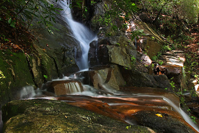
Maple Spring Branch Falls
The amazing thing about this photo is that it was hand held


Iggy


This last one was not actually on the hike.
It is one of my favorite waterfalls, none of the others have ever been here,
its a short/easy hike, and we would be driving right past on the drive back.
So I suggested we make a quick stop.
Eastatoe Falls

Plenty of additional photos to come later!

Friday, April 29, 2011

Thursday, April 28, 2011

The Jocassee Gorge Passage of the Palmetto Trail

The Jocassee Gorge Passage of the Palmetto Trail

Pickens County, SC
Sunday, April 24th, 2011

Photos are posted here:
http://outdoors.webshots.com/album/580105936KJXcdv

Slide Show Format:
http://outdoors.webshots.com/slideshow/580105936KJXcdv


The Jocassee Gorge Passage of the Palmetto Trail has been on my "to do" list since it was first open to the public about 5 years ago. The trail is listed at 12.6 miles long (one way). Therefore in order to complete the whole trail during a day hike I would need to arrange a shuttle.

Andy and Brenda also were interested so the shuttle problems were solved. Andy (and Boone) met me in Spartanburg and we drove together to the western trailhead on US178 where we would meet Brenda. There is no official parking at this trailhead, but about 200yards South is a pull-off wide enough for about 3 vehicles.

We left Brenda's vehicle there and combined into my truck for the ride to the Eastern Trailhead inside Table Rock State Park. I am not a big fan of shuttle hikes, because sometimes it seems you spend more time shuttling vehicles than actual hiking, but this one only took about 15 minutes.

There are probably safe places to park where you can avoid the $2.00/person SC State Park Entrance Fee, but we went ahead and paid the $6.00 and parked at the official trailhead inside Table Rock State Park by the Pinnacle Pavilion (aka The Barn).

We hit the trail at about 10:15am.

Boone

I am not going to write a whole lot of detail about the hike. Instead I will just give some general impressions and highlights about the trail.

About 70% of the route is a very well designed and constructed trail. All elevation changes are nice and gradual with heavy utilization of switchbacks.

About 30% of the route is on Forest Service Roads. When hiking these roads, it is very easy to miss the spot where the trail leaves the road. I was in the lead most of the time and I missed the turn on at least (3) different occasions. Some of these forest roads go on for miles and it would be very easy to get way off track. One missed turn added a little over a half mile to our hike total, but it could have been a lot more!

There were some wildflowers out, but overall I was disappointed with the wildflower display along the trail.

Fleabane Daisy

Just before Mile #1, the trail crosses over Mill Creek. Our buddy Johnny bushwhacked upstream and found a very impressive looking waterfall. Due to the long day ahead of us, we elected to save that for another time.

At around Mile Marker #3, the trail crosses Rachel Creek and a couple of its tributaries. The trail map shows a waterfall here, but it is very unimpressive and not even worth a photo.

A much more impressive looking waterfall is located on Rachel Creek downstream from the trail. Our Buddy Waterfall Rich found this waterfall by bushwhacking upstream from Hwy 11. I believe Rich's route requires crossing private property.

It should be possible to access this waterfall and staying entirely on public land if you followed the creek downstream from the Palmetto Trail. We didn't try it today, but I will plan a return visit to explore both Mill Creek and Rachel Creek in hopes of finding these waterfalls!

The trail crosses Emory Creek at around mile 7 just upstream from an impressive looking waterfall. Andy and I bushwhacked down to the base while Brenda took a nice break. Photo conditions where lousy, but this one is definitely more impressive than this photo shows.

Waterfall on Emory Creek

I attempted to get a better view, but almost went for an unintended swim! The water was much deeper and the rocks much slipperier than expected. I might have tried again, but the photo conditions did not justify the risk.  Plus, I decided not to bring the Tri-Pod along for this hike which would explain the poor focus on the above photo!

There are lots of potential for waterfalls on Emory Creek both upstream and downstream from the trail. However, Hiking 7 miles (one way) just to get to this point does not leave much opportunity for exploration during a day hike. It appears that a Hunting Access Road leads to the same area and may be a good access option for further exploration of Emory Creek.

Much of this trail crosses through SCDNR Game Lands. We planned the hike for Sunday so we didn't have to worry about getting mistaken for Wild Turkeys and shot. However, any other day of the week, you should plan on the possibly of encountering Hunters!

We actually saw some Wild Turkeys and a couple of Deere, but the only wildlife I was able to get a photo of was a Toad:


There are some nice views through the trees, which would be even better in the winter. However, there are really no wide open spectacular vistas!

This was probably the best view the trail has to offer


Elevation starts at around 1200-ft, peaks at around 2,800-feet and ends at 1,800-feet with a few ups and downs in between. It would make for a slightly easier hike by going in the reverse direction from how we did it.
Elevation Profile

We finished up at about 5:30pm which means that it took us just over 7 hours to complete the hike. This includes (2) extended sit-down breaks and a couple of other short breaks. It also includes the (1) missed turn which added a little over a half mile to the total hike distance.

Hike Route

Overall it is a nice trail and it was a very enjoyable day hiking in the woods. However, there is absolutely nothing about this trail that would cause me to recommend it as "Must Hike" trail.

The full set of photos is posted here:
http://outdoors.webshots.com/album/580105936KJXcdv

Slide Show Format:
http://outdoors.webshots.com/slideshow/580105936KJXcdv

Wednesday, April 27, 2011

Mans Best Friend!

I spotted this gravesite while out hiking a section of the Palmetto Trail on Sunday.

PRINCE
MANS BEST FRIEND
7.28.93  -  7.21.05

It seemed like kind of a strange place to see a headstone for someones deceased pet.  However, the date of death is around the time when this trail was being constructed.  I assume that Prince belonged to someone involved in the planning and/or construction of this trail.


Tuesday, April 26, 2011

Mountain Bridge Wilderness Hike

Greenville County, SC
Saturday, April 23rd, 2011

Photos are posted here:
http://outdoors.webshots.com/album/580103995kgdfxJ

Slide Show Format:
http://outdoors.webshots.com/slideshow/580103995kgdfxJ


It has been a while since I have done a nice long solo hike, but since none of my usual hiking buddies were able to get out on Saturday, I decided to plan a hike on my own.

When hiking solo, I like to stick with established trails, in places that I am familiar with. I also make sure that my wife Amy knows exactly where I will be and what trails I plan on hiking.

I decided on the Mountain Bridge Wilderness Area of South Carolina. I printed out an extra copy of the map and highlighted my planned hike route to leave with Amy.

Middle Saluda River
Jones Gap State Park
Mountain Bridge Wilderness, SC


Years ago I wrote and article for the Hiking the Carolinas website called "The Ultimate South Carolina Dayhike Loop"
http://www.hikingthecarolinas.com/ultimate_sc_day_loop.php

It has been a long time since I have done this hike and I originally planned on doing the exact hike described. However, it was a dreary morning with thick fog and a light mist of rain. These are actually perfect conditions for photographing waterfalls and cascades.

Middle Saluda River

Therefore I decided to do the loop in reverse (counter clock-wise). This would give me perfect conditions for the Creekside portion of the hike, and hopefully allow things to clear up by the time I got to the higher elevation views.

I arrived at Jones Gap State Park right when they opened the gates at 9:00am and hit the trail. I was right about conditions being just about perfect for photography and took my time as I made my way up the Jones Gap Trail alongside the Middle Saluda River. Higher than normal water flow and blooming Rhododendrons alongside the creek was an added bonus!

Rhododendrons Blooming along the Middle Saluda River

There was also loads of trillium alongside the Jones Gap Trail. Most of the ones near the start of the hike had started to droop and fade away for the year, but as I gradually gained elevation the specimens started getting better and better.

Trillium

About a mile in, I reached Jones Gap Falls. This is normally a fairly unimpressive waterfall, but with the water levels up it was more impressive than I have ever seen it. I've been to this waterfall dozens of times and this is the first time I got what I consider to be a good photo of it!

Jones Gap Falls

Me at Jones Gap Falls


After enjoying Jones Gap Falls, I continued along the Middle Saluda River to the Coldspring Branch Trail Intersection. The Coldspring Branch Trail has about 6 or 7 creek crossings. They are normally pretty easy to rock hop across, but with the higher than normal water, I decided to avoid all the creek crossings and instead take the Bill Kimbal Trail.

This would be the steepest climb of the day as the Bill Kimbal Trail gains more than 1,000 feet of elevation over about 2 miles. With 100% humidity, I was sweating up a storm. But suddenly, I broke through the fog and was above the clouds.

Along the Bill Kimbal Trail

Through the trees, I could see clear blue sky above and white clouds below. Unfortunately the Bill Kimbal Trail does not really have any open views so I was forced to do a bit of off trail bushwhack to reach a small opening in the trees.

View from slightly off the Bill Kimbal Trail


Back on the trail, I soon met back up with the Coldspring Branch Trail and took a couple of short connector trails to start the Rim of the Gap!

The Rim of the Gap starts at the top of Cliff Falls and switchbacks a few hundred feet down to the base. By now the sun was directly above Cliff Falls making for lighting so horrible that I didn't even bother to snap a shot.

The next 2 miles is the most rugged stretch of trail in the Mountain Bridge Wilderness Area as the trail hugs the base of a rocky cliff. You definitely have to use all four limbs to make your way along this trail.

Fiddleheads along the Rim of the Gap Trail

Several tributaries flow down the rocks and across the trail. During wet weather, many of these make for some fairly impressive waterfalls. Unfortunately, the trail is right up against them making it tough to compose a good photo. The bright sunlight which was now overhead did not help matters.

One of the many waterfalls flowing across the Rim of the Gap Trail

There was a nice display of wildflowers, and at one place along the Rim of the Gap I spotted the most Jack-in-the-Pulpit's I have ever seen in one place. While not the prettiest of all wildflowers, it is one of my favorites due to the fact that it is so unique and fairly uncommon.


Jack-in-the-Pulpit
The are a couple of spots along the trail that offer up some nice views across the Gorge and down into the Middle Saluda Valley

View from the Rim of the Gap Trail

Another interesting feature along the Rim of the Gap is Weight Watchers Rock. If you can't fit through the rock, it is time for a diet. There are ways to get around, but it is more fun to just shed your pack and climb on through.

Me crawling through Weight Watchers Rock

Next up, I left the Rim of the Gap via the John Sloan Trail. This is a very unexciting trail, but it is always an enjoyable and welcome relief to hike this relatively flat and wide track trail after the grueling miles that lead up to it.

I turned on the Pinnacle Pass Trail which would take me to the final highlight of the day. The earlier fog was gone leaving an awesome view of the Valley below and the cliffs along the opposite rim of the Gorge.

View from the Pinnacle Pass Trail

The final 2 miles was mostly a steep downhill climb. By the time I got back to Jones Gap State Park it was swarming with people, but I only saw about 10 other hikers on the trails throughout the day.

It was a very enjoyable day!  Here is a map of the area where I highlighted my hike route:

Click Map to Enlarge

The full set of photos is posted here:
http://outdoors.webshots.com/album/580103995kgdfxJ

Slide Show Format:
http://outdoors.webshots.com/slideshow/580103995kgdfxJ

Monday, April 25, 2011

Jack-in-the-Pulpit

The Jack-in-the-Pulpit is one of my favorite wildflowers.  It is definitely not the most attractive flower, but I like it becuase it is so unique and unlike any other type of wildflower. 

Here is one I found during my hike on Saturday.

Jack-in-the-Pulpid
Along the Rim of the Gap Trail
Mountain Bridge Wilderness, SC

Sunday, April 24, 2011

Buzzing around some Mountain Laurel

Just a quick shot from Today's hike on the Jocassee Gorge Passage of the Palmetto Trail

Saturday, April 23, 2011

Me at Jones Gap Falls

Here is a quick shot from todays hike!

Me at Jones Gap Falls
Mountain Bridge Wilderness, SC

Friday, April 22, 2011

Good Friday at Hatcher Garden

Hatcher Garden and Woodland Preserve
Spartanburg, SC
Friday, April 22nd, 2011

Thanks to Good Friday, I had the day off from work.  I originally planned to go hiking, but a rainy day forecast caused me to delay those plans until Saturday and/or Sunday.

Instead, I drove into downtown Spartanburg, SC to meet Amy for lunch as she doesn't get off for Good Friday.  After lunch, the rain had subsided to only a light mist and since I was driving right past, I made a stop to stroll around Hatcher Garden where I took this series of shots.

Raindrops


Mushrooms


Spiderwort


Along came a Spider


Columbine


Macro Shot


Mountain Laurel


Mountain Laurel

Orchid

My wife Amy is not a big fan of receiving fresh cut flowers.  The idea of dropping 50 bucks on something that will be dead in a week sickens her.  On the other hand, it is nice to surprise your wife with a little something every now and then.

For our anniversary last week, instead of fresh cut flowers I had an Orchid delivered to her.  Hopefully we can keep this beautiful flowering plant alive for years to come.  Here are a few shots I took this morning.


Thursday, April 21, 2011

Gypsy Moth Caterpillar

I am definitely not a fan of these guys as they can wreck havoc on trees,
but they do make for a cool Macro Shot
Gypsy Moth Caterpillar (I think?)

Wednesday, April 20, 2011

Iris

We have a bunch of Iris growing around our property, but most of them never bloom.  I think they get too much shade.  But every year one or two of them decide to produce some blooms.  There wasn't much of a breeze the other day when I took these shots, so I decided it would be a good time to get out the Tri-Pod and Macro Lens.


Meet Zoey

 Meet Zoey! Amy and I just adopted this beautiful girl!