DuPont State Forest Waterfall Hike
Transylvania County, NC
Saturday, February 25th, 2012
My brother-in-law Hugh and I decided that we needed to escape the Sane craziness for a little while and head up to the mountains. DuPont State Forest is one of my favorite places to take people who have not seen much of the area.
We parked at the Hooker Falls / Triple Falls parking area and started out with the quick and easy quarter mile warm up hike to Hooker Falls. It was a beautiful morning, but the intense sun was located above the waterfall and shining directly into my camera lens. I quickly realized that this would not be a good day for waterfall photography, but it was still a beautiful day for a hike!
Hooker Falls
We crossed the road, and headed out on the Triple Falls Trail. After the initial flat section, we began the short but steep climb to the Triple Falls overlook area. This is the best spot to view all three drops of Triple Falls from one vantage point!
Triple Falls
The Middle Drop of Triple Falls
High Falls
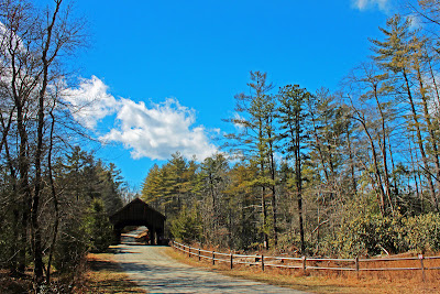
The DuPont Covered Bridge
From the Covered Bridge, we turned onto Conservation Road and then took the Pitch Pine Trail. We crossed Joanna Road and then took the "Three Lakes Trail".
The Three Lakes Trail used to be called the Lake Dense Trail which would take you past Lake Dense and then dead end at Lake Alford. However, this trail has recently been extended to also include Lake Julia and hence the name change to the "Three Lakes Trail"
Lake Julia
The new Three Lakes Trailhead at Conservation Road
The DuPont Barn
So we started the climb alongside Bridal Veil Falls. The rock incline was mostly dry making this much easier than it is during times of high water or recent rain. We probably could have made it all the way to the upper drop, but there were some slick spots towards the end. Just to be on the safe side, we decided to head into the woods for the final 50 yards or so.
We exited the woods right next to the upper drop of Bridal Veil Falls. There was really no point to what I was about to do, but I led Hugh underneath and behind the waterfall!
Hugh Crossing under Bridal Veil Falls
We made it safely across the river and took a little break to enjoy the view from the other side.
The Upper Drop of Bridal Veil Falls
This meant going back under Bridal Veil Falls and heading back the way we came. I did throw in a few minor variations for the hike back. For the return route we stuck to Conservation Road instead of the Three Lakes and Pitch Pine Trails. We also avoided the River Bend Trail and instead elected for the more distant view of High Falls.
High Falls
Me at the Lower Drop of Triple Falls
Hugh at the Caesars Head Overlook
It was a beautiful day for a hike and it was great to give Hugh a little taste of what the Carolina Mountains have to offer!
The bright sun did not make for optimal waterfall photography, but that didn't stop me from trying! The complete set of photos is posted here:


3 comments:
That was nice of you to take him to see that park. A really good place to introduce folk to our mountains.
Nice to know about Three Lakes Trail. I'll have to look for that the next time I'm up that way.
High falls looks amazing
Post a Comment