
Transylvania County, NC
Saturday, April 30th, 2011
Photos are posted here:
http://outdoors.webshots.com/album/580135403vOHOPI
Slide Show Format:
http://outdoors.webshots.com/slideshow/580135403vOHOPI
North Carolina's Gorges State Park is one of the newest additions to the North Carolina State Park System. It is loaded with impressive, but hard to get to waterfalls and cascades. However, for some reason, I have done very little exploring in the area.
When I saw the Upstate Hiking and Outdoor Adventures Group had a hike planned to a side of the park that I have never seen, I signed up.
I had a little time to kill before meeting the group, so I made a quick stop at Wildcat Branch Falls on the drive up.

Wildcat Branch Falls
A total of six of us (Caroline, Tim, Coop, Glara, Melissa, and Me) started the hike at the Frozen Creek Road access on the North-East side of Gorges State Park. Our plan was to hike the Auger Hole Trail out and back to the Toxaway River and hopefully find some waterfalls along the way.
The Auger Hole trail is more of a Forest Service Road than an actual trail. In addition to hikers, it is also open to Mountain Bikes and Horses. There are a few gradual up and downs in the beginning, but it soon becomes all down hill. The elevation change is gradual, but it will still be mostly uphill on the hike out!
At a little over the 2.0 mile point, we left the main trail in search of some waterfalls. The "side trail" to Auger Hole Falls and Maple Spring Branch Falls is definitely not obvious, but after a bit of trial and error, we eventually found our way down to the two Waterfalls.

Me at Auger Hole Falls
From the base, Auger Hole Falls is definitely the more photogenic, but with the bright sun, getting a good shot was a challenge. I will definitely want to get back here during a nice overcast day.
You can see enough of Maple Spring Branch Falls through the heavy vegetation to tell it is an impressive waterfall, but you can't compose much of a shot from the base. Fortunately, Glara spotted a little scramble path up the right side of the waterfall that led to a much better viewpoint.

Maple Spring Branch Falls
Note: Those are Tim's hands in the upper right trying to help me block the sun!
We spent a good bit of time enjoying the two waterfalls, before beginning the steep climb back up to the main trail.

Climbing up the Steep Hillside
We continued on for another 1.5 miles to the point where the trail crosses the Toxaway River. While we could have easily waded across, we decided to make this our turn around point and main break spot for the day.

Me taking a break along the Toxaway River
On the hike back we explored a little up an old logging road. I believe this road would eventually lead to Wintergreen Falls, but we didn't know that at the time and turned back after about a half mile.
Caroline and I also decided to scramble down the bank to check out another cascade along a tributary stream.

Small Cascade
The remainder of the hike was uneventful. We didn't see a single other person all day long until the very end of the hike where we ran into a couple of backpackers and a dog.

One of only (3) other hikers we encountered
While the bright sunshine did not make for ideal photography, it did make for a beautiful day. I got enough of a feel for the area to know that I definitely have to get back! Thanks to Caroline and Tim for leading this hike!
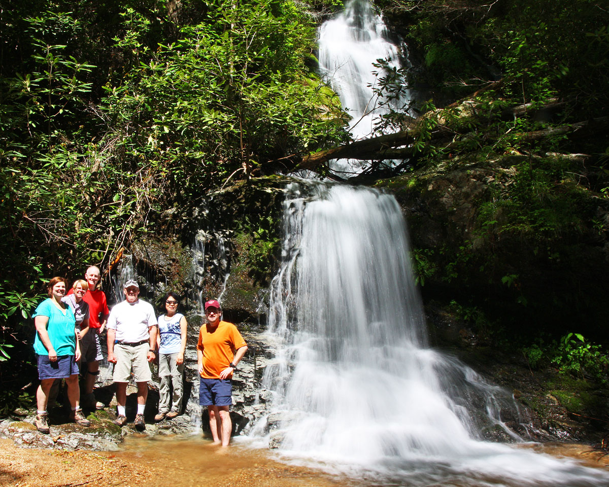
Group shot at Auger Hole Falls
On the drive back, I suggested we make a quick stop to check out Eastatoe Falls. It was late enough in the day that the bright sun had dropped behind the ridgeline making for some excellent photo opportunities!

Eastatoe Falls
The full set of photos is posted here:
http://outdoors.webshots.com/album/580135403vOHOPI
Slide Show Format:
http://outdoors.webshots.com/slideshow/580135403vOHOPI


1 comment:
Awesome pics and park!
Later,
Mark
Post a Comment