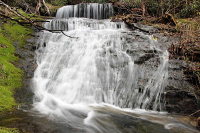
The Waterfalls of Rocky Bottom Creek
Another Team Waterfall Adventure
Pickens County, SC
Saturday, March 19th, 2016
On Saturday, I joined a large group of my Team Waterfall friends on an off trail adventure to the headwaters of Rocky Bottom Creek. Between Andy and Brenda, Team Waterfall has discovered at least (7) significant waterfalls along this creek over the past few months.
I got an early start on the day, so I decided to make a few stops along the way.
Peach Orchard in Bloom at the base of Hogback Mountain
Table Rock State Park, SC
Table Rock Reflections
We started the main part of our day from the summit of Sassafras Mountain (the highest spot in South Carolina). There would be (9) of us plus (3) dogs along for this hike. (Brenda, Andy, Darrin, Mitch, Dillon, Lauren, Michael, Spencer, Me, Blizzy, Boone, and Kona).
The Foothills Trail crosses over Sassafras Mountain, but there would be no trails where we were headed. A series of overgrown logging roads took us most of the way, but once we were within earshot of the creek it was a complete bushwhack.
We started out along the Eastern Tributary. Our first stop was Windhover Falls, recently discovered by Brenda and named after her close friend who recently passed away. My photos definitely do not do this one justice!
Lower Windhover Falls
Upper Windhover Falls
A few hundred yards downstream from Windhover Falls is Abby's Falls
Dillon and Darrin at Abby's Falls
Upper Abby's Falls
Immediately downstream from Abby's Falls, the Eastern and Western Tributaries come together. Confluence Falls is on the Western Tributary right at the confluence.
Continuing downstream the next major drop is what Andy has named Firefly Falls.
Spencer at the Upper Drop of Firefly Falls
Michael above the Middle Drop of Firefly Falls
Firefly Falls
Brenda at Firefly Falls
There are still at least 3 or 4 more waterfalls downstream, and about half the team was planning to continue on. Brenda, Darrin, Mitch, and I decided that we would turn around at this point. We went up the Western Tributary on the way back for a ways and did notice any more significant drops upstream from the confluence.
Here is the GPS track from our adventure.
GPS Track
After the hike, I took one more obligatory photo from the Sassafras Mountain Overlook.
view from the Sassafras Mountain Overlook
The forecast for the day was a 90% chance of rain. It turned out to be mostly sunny without a drop of rain! it was a beautiful day to be outside!
The complete set of photos is posted here:
https://www.flickr.com/photos/8146392@N05/albums/72157666175640996


No comments:
Post a Comment