
Saluda area Waterfalls and Railroad Hike
with Keith and Jay
Melrose Falls
The Saluda Grade Railroad
Fungi Falls
Sunday, February 7th, 2016
The Saluda Grade running between the towns of Tryon and Saluda, NC is the steepest standard-gauge railway in the United States. The Norfolk Southern Railway suspended use of the tracks back in 2001. I recently heard rumors that the tracks are now open to the public for hiking allowing a much closer view of Melrose Falls on Big Fall Creek.
I decided to join Keith and his friend Jay on a hike to Melrose Falls which would include a short section of the old Saluda Grade Railway.
Our starting point would be the Twin Bridge bridges area along US176 between Saluda and Tryon. However since this section of US176 is closed due to a rock slide, we just parked along the shoulder just before the barricade and walked down the road towards the twin bridges.

Hike Leader Keith at the start of our hike

The North Pacolet River from the Twin Bridges

Interesting Graffiti under one of the Twin Bridges
From the Twin Bridges we could see where the rock slide occurred, so we hiked a little further down the road to check it out.

This explains why the road was closed

Jay checking out the rock slide
We backtracked and hit the trail heading east which runs through Pacolet Area Conservancy land towards Big Fall Creek. This creek is actually a long series of cascades and waterfalls. Probably the most impressive of which is the first one we arrived at which I am calling Lower Melrose Falls.

Lower Melrose Falls

Keith, Jay, and Me at Lower Melrose Falls
From there we continued upstream to the railroad trestle above Big Falls Creek.

Keith and Jay walking across the railroad trestel above Big Falls Creek
Just upstream from the railroad trestle is Melrose Falls.
Melrose Falls (not huge, but bigger than it looks in this photo)

Nice Cascade just downstream from Melrose Falls
The next mile and a half of our hike was an easy walk along the train tracks.

Keith sitting on the tracks

Jay and Keith hiking along the tracks

Some ice alongside the tracks
We exited the tracks through a small subdivision that had a bridge across the Pacolet River which brought us out onto US176 a short distance from our starting point. Here is the GPS track from our hike.

GPS Track of Hike


There was still plenty of time left to do another short Waterfall hike. I would take the lead on this one since neither Keith or Jay had ever been to Fungi Falls.
For this visit I am just going to post a few photos taken under horrible light for waterfall photography.

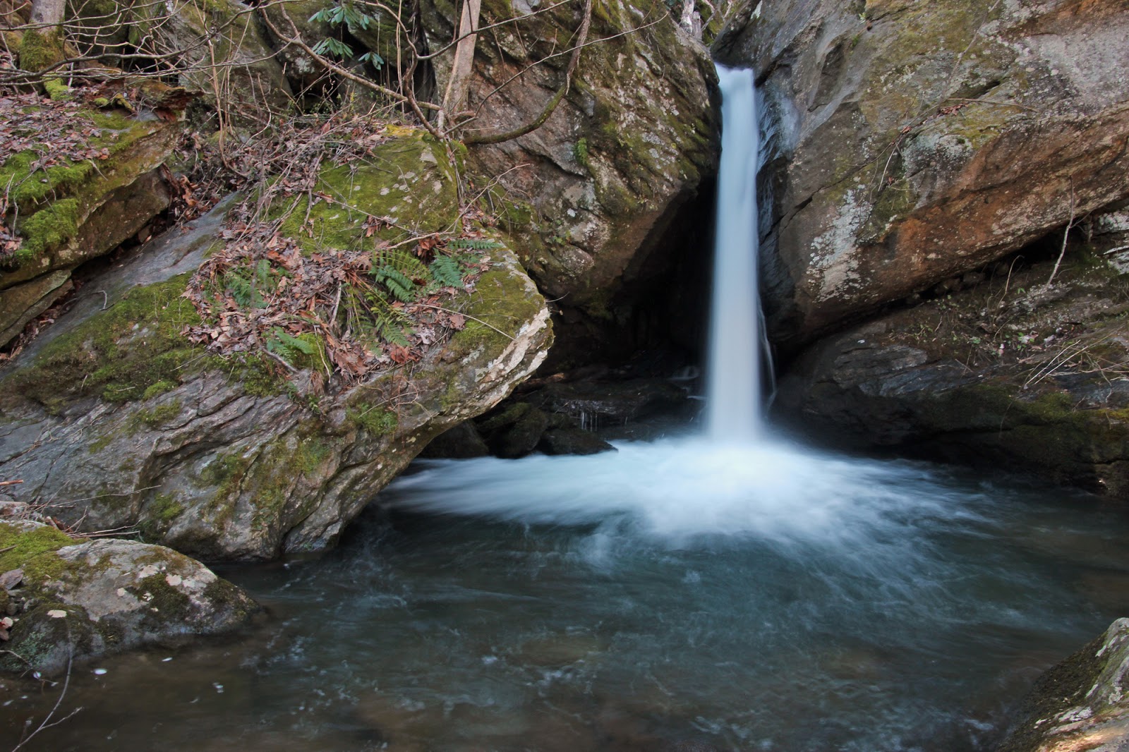
Fungi Falls

Fungi Falls

Keith and Jay at Fungi Falls

Fungi Falls
It was another great day to be outside!
My complete set of photos is posted here:


No comments:
Post a Comment